Mount Pleasant in Charleston County, South Carolina — The American South (South Atlantic)
Laing School
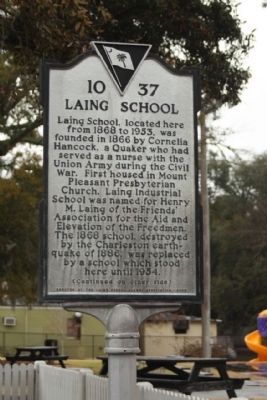
Laing School located here from 1868 to 1953 was founded in 1866 by Cornelia Hancock, a Quaker who had served as a nurse with the Union Army during the Civil War. First housed in Mount Pleasant Presbyterian Church, Laing Industrial School was named for Henry M. Laing of the Friends Association for the Aid and Elevation of the Freedmen. The 1868 school destroyed by the Charleston Earthquake of 1886 was replaced by a school which stood here until 1954.
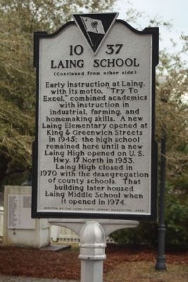
Early instruction at Laing with its motto “Try to Excel” combined academics with instruction in industrial, farming and homemaking skills. A new Laing Elementary opened at King and Greenwich Streets in 1945; the high school remained here until a new Laing High opened on U.S. Hwy. 17 North in 1953. Laing High closed in 1970 with the desegregation of county schools. That building later housed Laing Middle School when it opened in 1974.
Erected 2002 by The Laing School Alumni Association. (Marker Number 10-37.)
Topics. This historical marker is listed in this topic list: Notable Buildings. A significant historical year for this entry is 1868.
Location. 32° 47.19′ N, 79° 52.424′ W. Marker is in Mount Pleasant, South Carolina, in Charleston County. Marker is on Royall Avenue near King Street, on the right when traveling north. Touch for map. Marker is in this post office area: Mount Pleasant SC 29464, United States of America. Touch for directions.
Other nearby markers. At least 8 other markers are within walking distance of this marker. Friendship A.M.E. Church (within shouting distance of this marker); Confederate Cemetery / Memorial (about 300 feet away, measured in a direct line); War of 1812 Encampment (about 300 feet away); Darby Building (about 400 feet away); "Storm of the Century" (about 600 feet away); Patjens Post Office (about 700 feet away); Ronkin's Long Room / Ferry Service (approx. 0.2 miles away); The Old Village (approx. 0.2 miles away). Touch for a list and map of all markers in Mount Pleasant.
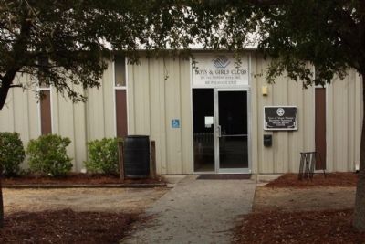
Regarding Laing School. Today, this is the location of the Mount Pleasant Boys and Girls Club
Credits. This page was last revised on June 21, 2023. It was originally submitted on January 2, 2011, by Mike Stroud of Bluffton, South Carolina. This page has been viewed 747 times since then and 31 times this year. Photos: 1, 2, 3, 4. submitted on January 7, 2011, by Mike Stroud of Bluffton, South Carolina.


