Near Blythe in Riverside County, California — The American West (Pacific Coastal)
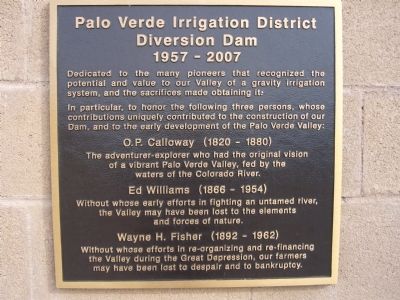
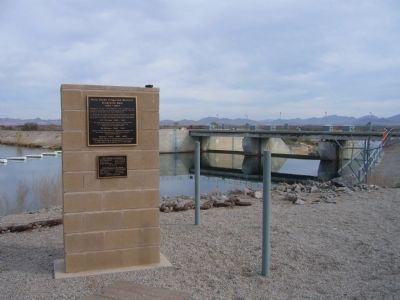
Palo Verde Irrigation District Diversion Dam
1957 – 2007
Inscription.
Dedicated to the many pioneers that recognized the potential and value to our Valley of a gravity irrigation system, and the sacrifices made obtaining it.
In particular, to honor the following three persons, whose contributions uniquely contributed to the construction of our Dam, and to the early development of the Palo Verde Valley:
The adventurer-explorer who had the original vision
of a vibrant Palo Verde Valley, fed by the
waters of the Colorado River.
Ed Williams (1866-1954)
Without whose early efforts in fighting an untamed river,
the Valley may have been lost to the elements
and forces of nature.
Wayne H. Fisher (1892-1962)
Without whose efforts in re-organizing and re-financing
the Valley during the Great Depression, our farmers
may have been lost to despair and to bankruptcy.
Topics. This historical marker is listed in these topic lists: Agriculture • Waterways & Vessels.
Location. 33° 43.91′ N, 114° 30.758′ W. Marker is near Blythe, California, in Riverside County. Marker can be reached from U.S. 95 at milepost 10.5,, 0.2 miles east of U.S. 95. Touch for map. Marker is in this post office area: Blythe CA 92225, United States of America. Touch for directions.
Other nearby markers. At least 7 other markers are within 14 miles of this marker, measured as the crow flies. Blythe Intake (approx. 0.2 miles away); In Memory of Hualapai Ancestors (approx. 4.3 miles away in Arizona); Giant Desert Figures (approx. 4.8 miles away); Desert Strike (approx. 8˝ miles away); Pioneer Cemetery (approx. 8.7 miles away in Arizona); Ehrenberg Cemetery (approx. 8.8 miles away in Arizona); 390th Bomb Group (H) (approx. 14.1 miles away).
Credits. This page was last revised on October 29, 2020. It was originally submitted on January 3, 2011, by Bill Kirchner of Tucson, Arizona. This page has been viewed 1,097 times since then and 24 times this year. Photos: 1, 2, 3. submitted on January 3, 2011, by Bill Kirchner of Tucson, Arizona. • Syd Whittle was the editor who published this page.


