Mount Pleasant in Charleston County, South Carolina — The American South (South Atlantic)
War of 1812 Encampment
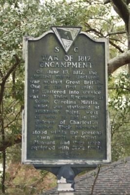
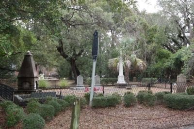
On June 18, 1812, the United States declared war against Great Britain. One of the first units to be mustered into service was the Third Regiment of South Carolina Militia, which was stationed at Haddrell's Point, west of here, to aid in the defense of Charleston harbor. Their barracks stood within the present town limits of Mount Pleasant, and they were equipped with State funds.
(Reverse text)
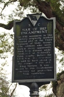
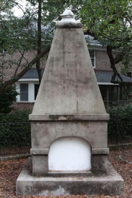
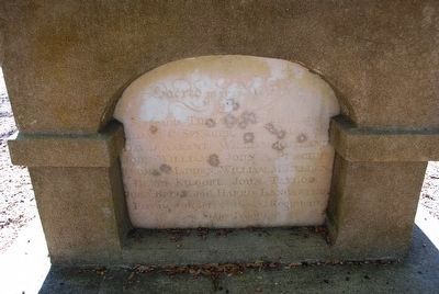
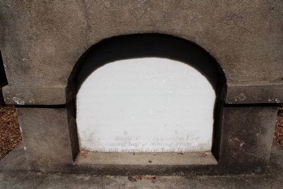
The 1812 monument in this cemetery originally marked a burial plot of the Third Regiment of State troops. The soldiers who were buried there apparently died from disease while stationed at Haddrell's Point, nearby. Before the Civil War, the monument is said to have stood at the corner of Pitt and King Streets. It was moved to this Confederate cemetery for protection from vandalism.
Erected 1970 by The United States Daughters of 1812, South Carolina Society. (Marker Number 10-10.)
Topics and series. This historical marker is listed in this topic list: War of 1812. In addition, it is included in the United States Daughters of 1812, National Society series list. A significant historical month for this entry is June 1912.
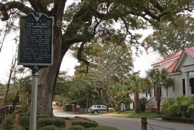
Location. 32° 47.135′ N, 79° 52.428′ W. Marker is in Mount Pleasant, South Carolina, in Charleston County. Marker is on Carr Street, on the left when traveling east. Located between King Street and Bank Street heading Southeast, at the Confederate Cemetery. Touch for map. Marker is in this post office area: Mount Pleasant SC 29464, United States of America. Touch for directions.
Other nearby markers. At least 8 other markers are within walking distance of this marker. Confederate Cemetery / Memorial (a few steps from this marker); Darby Building (within shouting distance of this marker); Friendship A.M.E. Church (within shouting distance of this marker); Laing School (about 300 feet away, measured in a direct line); Patjens Post Office (about 400 feet away); "Storm of the Century" (about 400 feet away); Ronkin's Long Room / Ferry Service (about 500 feet away); The Old Village (about 700 feet away). Touch for a list and map of all markers in Mount Pleasant.
Also see . . . The War of 1812. a military conflict fought between the forces of the United States of America and those of the British Empire. The Americans declared war in 1812 for several reasons, including trade restrictions brought about by Britain's ongoing war with France, the impressment of American merchant sailors into the Royal Navy, British support of American Indian tribes against American expansion, outrage over insults to national honour after humiliations on the high seas, and possible American desire to annex Canada. (Submitted on June 28, 2012, by Mike Stroud of Bluffton, South Carolina.)
Credits. This page was last revised on June 16, 2016. It was originally submitted on January 6, 2011, by Mike Stroud of Bluffton, South Carolina. This page has been viewed 1,181 times since then and 22 times this year. Photos: 1, 2, 3, 4, 5. submitted on January 12, 2011, by Mike Stroud of Bluffton, South Carolina. 6, 7. submitted on August 10, 2015, by Brandon Fletcher of Chattanooga, Tennessee.
