Raymond in Madera County, California — The American West (Pacific Coastal)
Raymond
(Wild Cat Station)
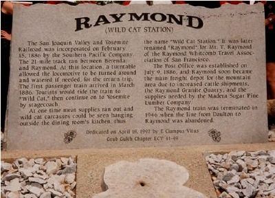
Inscription.
The San Joaquin Valley and Yosemite Railroad was incorporated on February 15, 1886 by the Southern Pacific Company. The 21 miletrack ran between Berenda and Raymond. At this location, a turntable allowed the locomotive to be turned around and watered if needed, for the return trip. The first passenger train arrived in March 1886. Tourists would ride the train to "Wild Cat", then continue to Yosemite by stagecoach.
At one time meat supplies ran out and wild cat carcasses could be seen hanging outside the dining room's kitchen, thus the name "Wild Cat Station." It was later renamed "Raymond" for Mr, T. Ramond of the Raymond Whitcomb Travel Association of San Francisco.
The Post Office was established on July 9, 1886, and Raymond soon became the main freight depot for the mountain area due to increased cattle shipments, the Raymond Granite Quarry, and the supplies needed by the Madera Sugar Pine Lumber Company.
The Raymond train was terminated in 1946 when the line from Daulton to Raymond was abandoned.
Erected 1997 by Grub Gulch Chapter 41-49, E Clampus Vitus.
Topics and series. This historical marker is listed in these topic lists: Railroads & Streetcars • Settlements & Settlers . In addition, it is included in the E Clampus Vitus series list. A significant historical month for this entry is February 1886.
Location. 37° 12.967′ N, 119° 54.383′ W. Marker is in Raymond, California, in Madera County. Marker is at the intersection of Harrison Street and Road 600 also known as The Raymond Road, on the left when traveling east on Harrison Street. Touch for map. Marker is at or near this postal address: across from 32197 Road 600, Raymond CA 93653, United States of America. Touch for directions.
Other nearby markers. At least 8 other markers are within 12 miles of this marker, measured as the crow flies. The Charles Miller House (approx. 0.2 miles away); Hydraulic Mining (approx. ¼ mile away); Knowles (approx. 1.1 miles away); Zebra Ranch - 1880's Yosemite Stage Route (approx. 7 miles away); Yosemite Stage Route (approx. 10 miles away); Grub Gulch (approx. 10.6 miles away); Willow Glen (approx. 10.9 miles away); Shay's Blacksmith Shop & Canary Cottage (approx. 12 miles away). Touch for a list and map of all markers in Raymond.
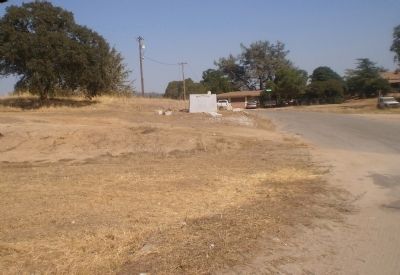
More about this marker. The marker sits where the railyard turntable used to be before the railroad was torn out in the late 1940's
Marker is a large slab of granite from the nearby Raymond Granite Quarry.
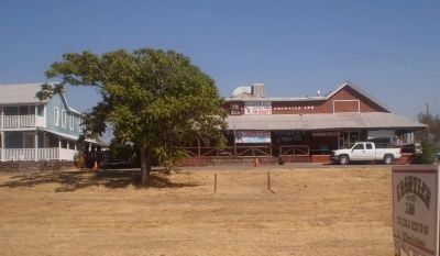
Regarding Raymond. Thee are only five or six buildings remaining on Road 600,
but the large swath of land that was the railroad corridor is clearly visible by the lack of any structures all he way through town. The Raymond monument is the only thing sitting in the railroad right-of-way.
Related markers. Click here for a list of markers that are related to this marker. To better understand the relationship, study each marker in the order shown.
Also see . . . Raymond Museum and Historic Town Site. Sierra Nevada Tourism entry. (Submitted on September 14, 2020, by Larry Gertner of New York, New York.)

Photographed By Lester J Letson, September 3, 2010
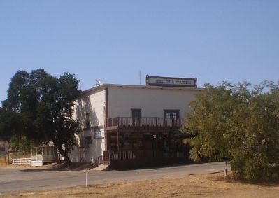
3. Raymond General Store, Est 1914
One of few buildings still standing, the building is well over 90 years old and is still in use as a General Store, Bar, and Soda Fountain.
The marker sits across Road 600 from the store. The picture was taken from the marker.
Credits. This page was last revised on September 14, 2020. It was originally submitted on January 7, 2011, by Lester J Letson of Fresno, California. This page has been viewed 1,353 times since then and 79 times this year. Photos: 1, 2, 3, 4. submitted on January 7, 2011, by Lester J Letson of Fresno, California. • Syd Whittle was the editor who published this page.


