Near Spotsylvania Courthouse in Spotsylvania County, Virginia — The American South (Mid-Atlantic)
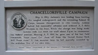
Chancellorsville Campaign
Erected by United States Department of the Interior - National Park Service.
Topics. This historical marker is listed in this topic list: War, US Civil. A significant historical date for this entry is May 2, 2004.
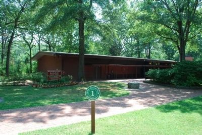
Location. 38° 18.674′ N, 77° 39.02′ W. Marker is near Spotsylvania Courthouse, Virginia, in Spotsylvania County. Marker can be reached from the intersection of Plank Road / Germania Highway (State Highway 3) and Bullock Road, on the right when traveling west. Located behind the Chancellorsville Visitors Center to the Fredericksburg & Spotsylvania National Military Park, on the "Wounding of Stonewall Jackson" walking trail. Touch for map. Marker is at or near this postal address: 9001 Plank Rd, Spotsylvania VA 22553, United States of America. Touch for directions.
Other nearby markers. At least 8 other markers are within walking distance of this marker. The Battle of Chancellorsville (within shouting distance of this marker); Memorializing Jackson's Death (within shouting distance of this marker); a different marker also named Chancellorsville Campaign (within shouting distance of this marker); Jackson Monuments (within shouting distance of this marker); Jackson (within shouting distance of this marker); Confederate Catastrophe (within shouting distance of this marker); a different marker also named Chancellorsville Campaign (within shouting distance of this marker); Fredericksburg and Spotsylvania National Military Park (within shouting distance of this marker). Touch for a list and map of all markers in Spotsylvania Courthouse.
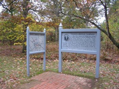
More about this marker. A map board stands next to the marker, showing the "Situation about 9 p.m., May 2, 1863."
Regarding Chancellorsville Campaign. This is one of several markers for the Battle of Chancellorsville along the Wounding of Stonewall Jackson walking trail. See the Wounding of Stonewall Jackson Tour by Markers in the links section for a listing of related markers on the tour.
Related markers. Click here for a list of markers that are related to this marker. Happel Markers for the Chancellorsville Battlefield.
Also see . . .
1. Fredericksburg & Spotsylvania National Military Park. National Park Service (Submitted on December 4, 2007, by Craig Swain of Leesburg, Virginia.)
2. Wounding of Stonewall Jackson Virtual Tour by Markers. This virtual tour includes markers on the Wounding of Stonewall Jackson walking trail and sites associated with the Jackson's death on May 10, 1863. (Submitted on December 8, 2007, by Craig Swain of Leesburg, Virginia.)
Credits. This page was last revised on July 9, 2021. It was originally submitted on December 4, 2007, by Craig Swain of Leesburg, Virginia. This page has been viewed 1,644 times since then and 16 times this year. Photos: 1, 2. submitted on December 4, 2007, by Craig Swain of Leesburg, Virginia. 3. submitted on July 25, 2015, by Brandon Fletcher of Chattanooga, Tennessee.


