Downtown in Trenton in Mercer County, New Jersey — The American Northeast (Mid-Atlantic)
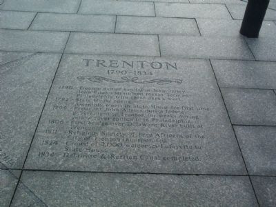
Trenton 1790–1834
1790 — Trenton named capital of New Jersey. John Fitch’s steamboat makes Trenton–Philadelphia trips three days a week.
1792 — State House opens. Assembly meets in State House for first time.
1799 — President John Adams moves federal government to Trenton for weeks during yellow fever epidemic in Philadelphia.
1806 — First bridge over Delaware River built at Trenton.
1811 — Religious Society of Free Africans of the City of Trenton incorporated.
1824 — Crowd of 2,000 welcomes Lafayette to State House.
1834 — Delaware & Raritan Canal completed.
Topics and series. This historical marker is listed in these topic lists: African Americans • Churches & Religion • Settlements & Settlers • Waterways & Vessels. In addition, it is included in the Former U.S. Presidents: #02 John Adams series list. A significant historical year for this entry is 1790.
Location. 40° 13.201′ N, 74° 46.334′ W. Marker is in Trenton, New Jersey, in Mercer County. It is in Downtown. Marker can be reached from West State Street east of Green Place. Touch for map. Marker is at or near this postal address: 185 W State St, Trenton NJ 08608, United States of America. Touch for directions.
Other nearby markers. At least 8 other markers are within walking distance of this marker. New Jersey State House Annex Dedication (about 500 feet away, measured in a direct line); George Washington White Oak (about 500 feet away); Veterans Memorial (about 800 feet away); World War II Memorial (approx. 0.2 miles away); West Front Street (approx. 0.2 miles away); Petty's Run (approx. 0.2 miles away); The Archives of the State (approx. 0.2 miles away); The Trenton Steel Works (approx. 0.2 miles away). Touch for a list and map of all markers in Trenton.
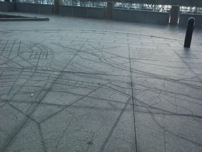
More about this marker. This marker is a stone inlay adjacent to an early 19th century map of the city of Trenton. This plaza is atop a parking garage between the New Jersey State House Annex and the New Jersey State Library, overlooking Route 29 and the Delaware River.
Credits. This page was last revised on February 16, 2023. It was originally submitted on November 29, 2007, by Gary Nigh of Trenton, New Jersey. This page has been viewed 1,054 times since then and 19 times this year. Last updated on December 5, 2007, by Gary Nigh of Trenton, New Jersey. Photos: 1, 2. submitted on November 29, 2007, by Gary Nigh of Trenton, New Jersey. • Kevin W. was the editor who published this page.

