Rough and Ready in Nevada County, California — The American West (Pacific Coastal)
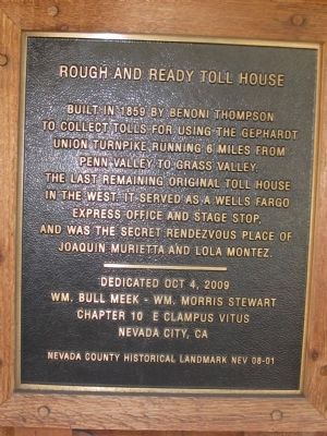
Rough and Ready Toll House
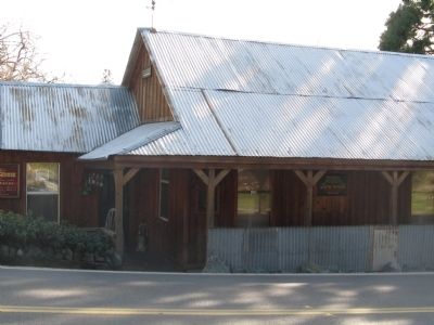
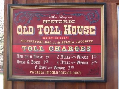
Built it 1859 by Benoni Thompson to collect tolls for using the Gephardt Union Turnpike running 6 miles from Penn Valley to Grass Valley. The last remaining original toll house in the West. It served as a Wells Fargo Express office and stage stop, and was the secret rendezvous place of Joaquin Murietta and Lola Montez.
Erected 2009 by Wm. Bull Meek - Wm. Morris Stewart Chapter No. 10, E Clampus Vitus, Nevada City, Ca. (Marker Number 08-01.)
Topics and series. This historical marker is listed in this topic list: Industry & Commerce. In addition, it is included in the E Clampus Vitus series list. A significant historical year for this entry is 1859.
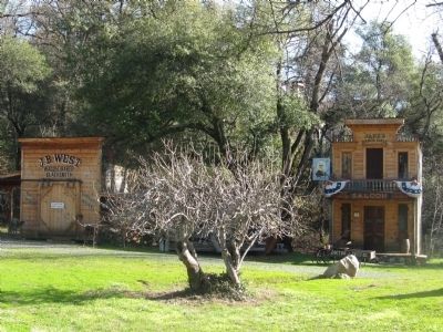
Location. 39° 13.8′ N, 121° 8.177′ W. Marker is in Rough and Ready, California, in Nevada County. Marker is on Rough and Ready Highway, on the right when traveling east. Marker is mounted on the front of the building near the entrance to the reconstructed pioneer town. Touch for map. Marker is at or near this postal address: 14365 Rough and Ready Highway, Rough and Ready CA 95975, United States of America. Touch for directions.
Other nearby markers. At least 8 other markers are within 4 miles of this marker, measured as the crow flies. Toll Road Stake (a few steps from this marker); Rowe Saw Mill (a few steps from this marker); The China Wall (a few steps from this marker); Indian Grinding Rock (a few steps from this marker); Fippin's Blacksmith Shop (about 700 feet away, measured in a direct line); Republic of Rough and Ready (about 700 feet away); Rough and Ready (about 700 feet away); Lyman Gilmore, Jr. (approx. 3.4 miles away). Touch for a list and map of all markers in Rough and Ready.
Also see . . .
1. Rough and Ready, California. Wikipedia entry (Submitted on April 10, 2023, by Larry Gertner of New York, New York.)
2. Rough and Ready. Ghost Towns website entry (Submitted on April 10, 2023, by Larry Gertner of New York, New York.)
Photographed By Syd Whittle, January 19, 2011
6. The Slave Girl Tree Located at the Western Town
This tree represents a famous tree which stood until 1962. The story of the tree can be read on the Chamber of Commerce "Also See" link above. A different story regarding the namesake of the tree can be found at this link.
Click for more information.
Click for more information.
Credits. This page was last revised on April 10, 2023. It was originally submitted on January 23, 2011, by Syd Whittle of Mesa, Arizona. This page has been viewed 1,046 times since then and 25 times this year. Photos: 1, 2, 3. submitted on January 23, 2011, by Syd Whittle of Mesa, Arizona. 4. submitted on January 20, 2011, by Syd Whittle of Mesa, Arizona. 5. submitted on January 23, 2011. 6. submitted on January 23, 2011, by Syd Whittle of Mesa, Arizona.
