Shirleysburg in Huntingdon County, Pennsylvania — The American Northeast (Mid-Atlantic)
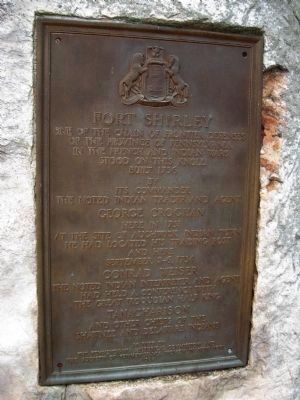
Fort Shirley
of the Province of Pennsylvania
in the French and Indian Wars
stood on this knoll,
built 1756
by
its Commander
the noted Indian trader and agent
George Croghan
here in 1753
at the site of Aughwick Indian Town
he had located his trading post
and here
September 3-6, 1754
Conrad Weiser
the noted Indian interpreter and agent
had held a conference with
the great Iroquoian half king
Tanacharisson
and other chiefs of the
Shawnee and Delaware Indians
Marked by the Pennsylvania Historical Commission and the Society of Pennsylvania Women in New York, 1926.
Erected 1926 by Pennsylvania Historical Commission and the Society of Pennsylvania Women in New York.
Topics and series. This historical marker is listed in these topic lists: Forts and Castles • Native Americans • Settlements & Settlers • War, French and Indian. In addition, it is included in the Pennsylvania Historical and Museum Commission series list. A significant historical month for this entry is September 1871.
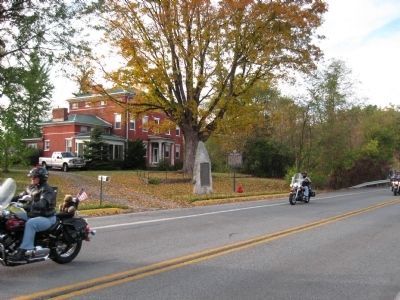
Location. 40° 18.074′ N, 77° 52.449′ W. Marker is in Shirleysburg, Pennsylvania, in Huntingdon County. Marker is on Croghan Pike (U.S. 522) just south of Pump Station Road, on the right when traveling south. Touch for map. Marker is in this post office area: Shirleysburg PA 17260, United States of America. Touch for directions.
Other nearby markers. At least 8 other markers are within 6 miles of this marker, measured as the crow flies. A different marker also named Fort Shirley (here, next to this marker); Orbisonia (approx. 4 miles away); Bedford Furnace (approx. 4.3 miles away); East Broad Top Railroad (approx. 4.4 miles away); Admiral Wm Sims (approx. 4.6 miles away); Juniata Iron (approx. 4.6 miles away); Mount Union Area Veterans Memorial (approx. 5.6 miles away); Stone House (approx. 5.9 miles away).
Additional keywords. Fort Shirley Conrad Weiser George Croghan Tanacharisson
Credits. This page was last revised on June 16, 2016. It was originally submitted on February 2, 2011, by Christopher Coleman of Columbus, Ohio. This page has been viewed 927 times since then and 31 times this year. Photos: 1. submitted on September 10, 2011, by Howard C. Ohlhous of Duanesburg, New York. 2, 3. submitted on July 21, 2011, by Howard C. Ohlhous of Duanesburg, New York. • Kevin W. was the editor who published this page.


