Arab in Marshall County, Alabama — The American South (East South Central)
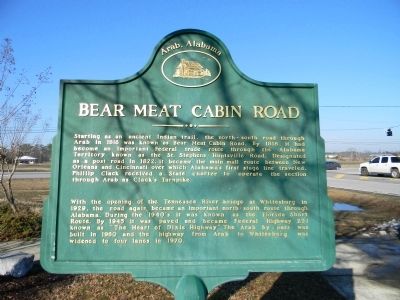
Bear Meat Cabin Road
With the opening of the Tennessee River Bridge at Whitesburg in 1929, the road again became an important north-south route through Alabama. During the 1940's it was known as the Florida Short Route. By 1945 it was paved and became Federal Highway 231 known as “The Heart of Dixie Highway”. The Arab by-pass was built in 1960 and the highway from Arab to Whitesburg was widened to four lanes in 1970.
Topics. This historical marker is listed in these topic lists: Industry & Commerce • Native Americans • Roads & Vehicles. A significant historical year for this entry is 1816.
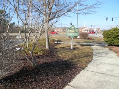
Location. 34° 20.434′ N, 86° 30.2′ W. Marker is in Arab, Alabama, in Marshall County. Marker is at the intersection of North Brindlee Mountain Parkway (State Highway 53) and North Main Street, on the right when traveling north on North Brindlee Mountain Parkway. Touch for map. Marker is at or near this postal address: 1206-1298 N Brindlee Mountain Pkwy, Arab AL 35016, United States of America. Touch for directions.
Other nearby markers. At least 8 other markers are within 4 miles of this marker, measured as the crow flies. Gilliam Springs Baptist Church (about 300 feet away, measured in a direct line); First United Methodist Church (approx. 0.4 miles away); First Baptist Church (approx. 1.3 miles away); First Arab High School / First Arab Auditorium (approx. 1.4 miles away); 1883 Methodist Church Cemetery (approx. 1˝ miles away); Farmer's Exchange (approx. 1.7 miles away); Stephen Tuttle Thompson (approx. 1.7 miles away); Shoal Creek Baptist Church (approx. 3.2 miles away). Touch for a list and map of all markers in Arab.
Credits. This page was last revised on June 16, 2016. It was originally submitted on February 7, 2011, by Judith Barber of Marietta, Georgia. This page has been viewed 1,875 times since then and 82 times this year. Photos: 1, 2. submitted on February 7, 2011, by Judith Barber of Marietta, Georgia. • Bernard Fisher was the editor who published this page.

