Cockburn Town in Grand Turk, Turks and Caicos Islands, British Overseas Territories — North Atlantic Ocean
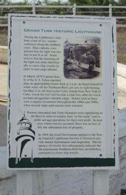
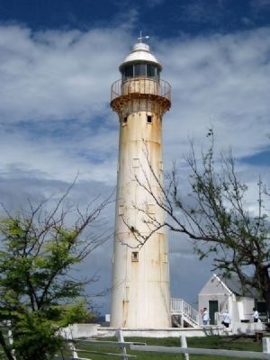
Grand Turk Historic Lighthouse
In March 1878 Captain Huehl of the S.S. Tybee reported that, on approaching Grand Turk at 2 a.m., he found himself in white water off the Northeast Reef, yet saw no light burning. On May 21st, the brig Lydia Coles, bound from New York to Cuba, struck the reef and became a total loss, after the wreckers had salvaged her valuable cargo. Stories such as these were a regular occurrence throughout the 1880s and 1890s, when several ships each season were wrecked.
Rumors abounded that Turk Islanders were capitalizing on the Reef in order to employ their "at the ready" and capable salvage operations for their own profit. In most cases where wrecks occured, there was no loss of life, but substantial loss of property.
In 1894, the local Government applied to the Trinity Imperial Lighthouse Service at Nassau to provide annual maintenance and inspection. The frequency of wrecks was subsequently reduced, but the treacherous Northeast Reef has, neverless, continued to claim ship wrecks.
Topics and series. This historical marker is listed in these topic lists: Industry & Commerce • Waterways & Vessels. In addition, it is included in the Lighthouses series list. A significant historical month for this entry is March 1878.
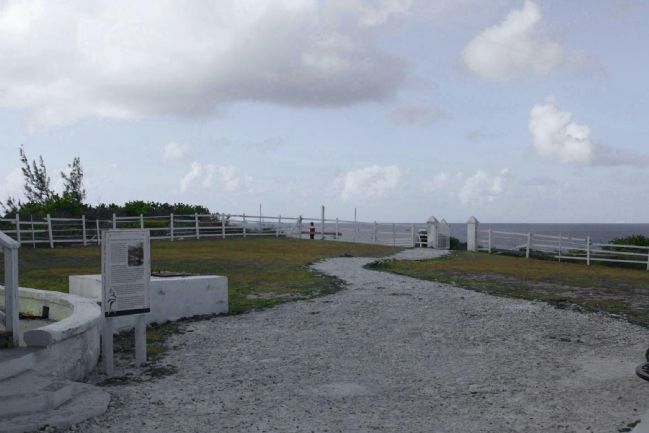
Location. 21° 30.697′ N, 71° 8.005′ W. Marker is in Cockburn Town, Turks and Caicos Islands, in Grand Turk. Marker can be reached from Lighthouse Road, on the left. Located at northern terminus of Lighthouse Road at Lookout Point . Touch for map. Marker is in this post office area: Cockburn Town, Turks and Caicos Islands 00109, British Overseas Territories. Touch for directions.
Other nearby markers. At least 8 other markers are within 5 kilometers of this marker, measured as the crow flies. A different marker also named Grand Turk Historic Lighthouse (a few steps from this marker); The Northeast Reef (within shouting distance of this marker); Grand Turk: The Original Columbus Landfall ? (within shouting distance of this marker); Horatio Nelson Lookout Point (within shouting distance of this marker); Trouvadore Shipwreck (within shouting distance of this marker); Lighthouse Keeper's Residence & Bermuda Kitchen (within shouting distance of this marker); U.S. Naval Facility (about 90 meters away, measured in a direct line); The History of the West (approx. 4.7 kilometers away). Touch for a list and map of all markers in Cockburn Town.
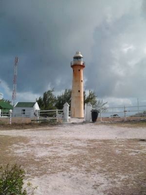
Regarding Grand Turk Historic Lighthouse. Reactivated (1998); focal plane 33 m (108 ft); white flash every 7.5 s. 18 m (60 ft) cast iron tower, painted white, attached to kerosene storage house. A 4th order Fresnel lens (1943) from the lighthouse is on display at the Turks and Caicos National Museum. The keeper's house and kitchen also survive. The lighthouse was prefabricated in London by Chance Brothers; it is a very rare example of this early design in cast iron. After many years of neglect, the lighthouse was partially restored in 1998. In 2006, Carnival Corp., the cruise line holding company, granted funds to repaint and refurbish the lighthouse, keeper's cottage, and other light station buildings. This was part of much larger investment to develop Grand Turk as a regular stop for cruise ships. Grand Turk suffered considerable damage from Hurricane Ike in September 2008 the lighthouse survived (though it needed repainting). Located at the northern tip of Grand Turk Island; accessible by road. . Site open, tower closed. Site manager: Turks and Caicos National Trust. ARLHS TCI-001; Admiralty J4812; NGA 12408.
Related marker. Click here for another marker that is related to this marker. To better understand the relationship, study marker shown.
Credits. This page was last revised on June 16, 2016. It was originally submitted on February 22, 2011, by Mike Stroud of Bluffton, South Carolina. This page has been viewed 1,114 times since then and 19 times this year. Photos: 1, 2, 3, 4. submitted on February 22, 2011, by Mike Stroud of Bluffton, South Carolina. 5. submitted on June 4, 2011, by Glenn Sheffield of Tampa, Florida.
