Glendale in Kane County, Utah — The American Mountains (Southwest)
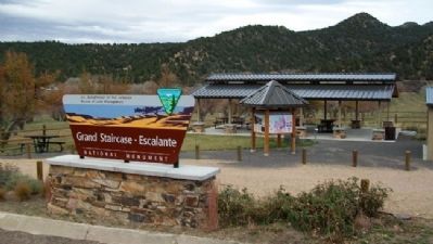
Glendale Orientation Center
Grand Staircase-Escalante National Monument
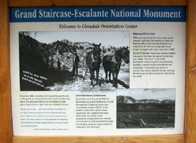
In the late 1800s, travelers who wanted to go to Kanab or Panguitch accompanied the mail carrier. In the early years, they traveled with him on horseback; in later years, they hitched a ride in his two-wheeled mailcart.
"No one who traveled...[this route] will forget Ned Walker and the 'sand.' He took new routes every other day through the sage brush so that the sand could be traversed more easily by his poor horses. This meant more bounce for his passenger if he happened to be riding and not walking to lighten the load. Such a day of travel was not soon forgotten."
-Adonis Findlay Robinson, History of Kane County
Highway 89 Corridor
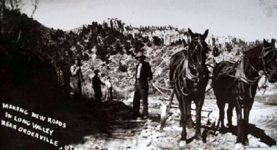
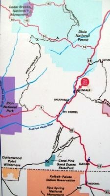
Although now one of the main travel routes between Salt Lake City and Kanab, Utah, the Highway 89 corridor through Glendale was useless for all vehicles except light horse-drawn carriages until it was improved in 1922.
South of Glendale, travel was severely limited because of the deep red sands of what was then called "the Sand" or Sand Hill. Nineteenth century travelers turned east at Glendale, crossed the Glendale Bench and Skutumpah, traveled through Johnson Canyon, then backtracked to Kanab, traveling 50 miles to go 20. But it was better than facing the sands.
Great American Landscapes
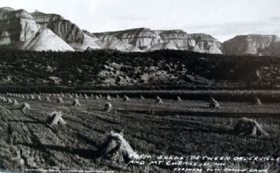
Grand Staircase-Escalante National Monument is a unit of the Bureau of Land Management's National Landscape Conservation System (NLCS) which protects some of the nation's most remarkable and rugged landscapes. NLCS lands will enable future generations to experience the solitude and splendor of undeveloped landscapes by providing numerous opportunities for exploration and discovery.
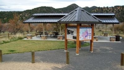
Erected by Bureau of Land Management.
Topics. This historical marker is listed in these topic lists: Environment • Industry & Commerce • Roads & Vehicles • Settlements & Settlers. A significant historical year for this entry is 1922.
Location. 37° 19.22′ N, 112° 35.87′ W. Marker is in Glendale, Utah, in Kane County. Marker is on Main Street (U.S. 89), on the left when traveling north. Touch for map. Marker is in this post office area: Glendale UT 84729, United States of America. Touch for directions.
Other nearby markers. At least 8 other markers are within 4 miles of this marker, measured as the crow flies. Millstones (here, next to this marker); The Berry Family (about 700 feet away, measured in a direct line); Glendale (approx. 0.3 miles away); United Order Woolen Mill (approx. 1˝ miles away); Orderville Bell (approx. 3.7 miles away); Old Rock Schoolhouse (approx. 3.7 miles away); United Order Industries (approx. 3.8 miles away); Cemetery at Orderville (approx. 4 miles away). Touch for a list and map of all markers in Glendale.
Credits. This page was last revised on September 14, 2020. It was originally submitted on February 22, 2011, by William Fischer, Jr. of Scranton, Pennsylvania. This page has been viewed 619 times since then and 11 times this year. Photos: 1, 2, 3, 4, 5, 6. submitted on February 23, 2011, by William Fischer, Jr. of Scranton, Pennsylvania.
