Near Panguitch in Garfield County, Utah — The American Mountains (Southwest)
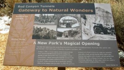
Red Canyon Tunnels
Gateway to Natural Wonders
A New Park's Magical Opening
"One little fairy hopped upon the running board and asked Governor Dern if he believed in fairies. 'Yes,' he said. 'Then,' said she, 'enter into Fairyland." - From Golden Nuggets of Pioneer Days, Daughters of Utah Pioneers, 1949
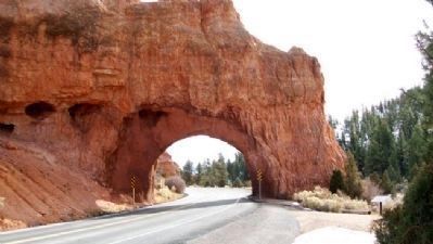
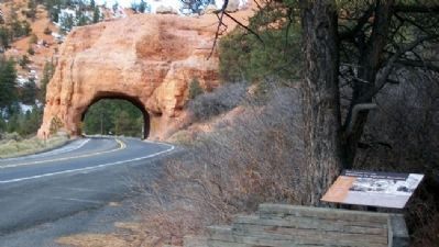
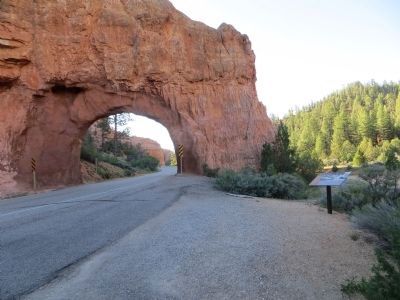
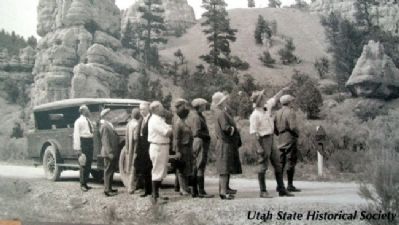
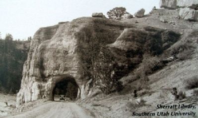
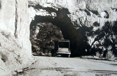
On June 1, 1925, a 315-car caravan, led by Governor George Dean, arrived at the Red Canyon tunnels to celebrate the opening of Utah National Park (later renamed Bryce Canyon National Park). A flower-strewn gate closed the entrance to the second tunnel, and a banner proclaimed "Welcome to Utah's Fairyland." Children dressed as fairies tied flowers and long ribbons to the bumper of the governor's car. When the governor pronounced his belief in fairies, two young elves opened the gates while a band, perched atop the tunnel, began to play. Dancing fairies pulled on the streamers (and men pushed from behind) to draw the car through the tunnel. Ever since that momentous celebration, the Red Canyon tunnels have served as a magical entrance to Red and Bryce Canyons.
Building the Tunnels
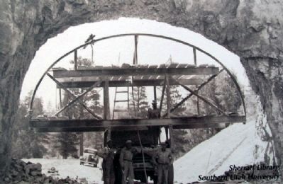
"We came upon what I have always considered the most beautiful piece of natural scenery on the face of the earth. ...Immediately upon my return to Panguitch, I began to make it possible to reach the canyon by automobile."
-W.J. Humphrey, Powell National Forest Supervisor, recollecting his first visit to Bryce Canyon circa 1915. Though it took nearly a decade of effort, Humphrey realized his dream of a road through Red Canyon.
Rusted Rocks
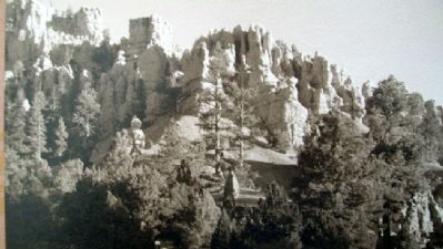
The bright formations of Red Canyon are largely limestone, built from sediment of a lake that covered this region 35-50 million years ago. The pink, orange, and red tones come from oxidized iron in the limestone - in other words, rust. Color hues depend on the amount of iron in the rock.
Erected by Scenic Byway 12 and Dixie National Forest.
Topics. This historical marker is listed in these topic lists: Environment • Horticulture & Forestry • Man-Made Features • Roads & Vehicles. A significant historical month for this entry is June 1906.
Location. 37° 44.453′ N, 112° 17.978′ W. Marker is near Panguitch, Utah, in Garfield County. Marker is on Utah Route 12, on the right when traveling east. Marker is in Dixie National Forest's Red Canyon. Touch for map. Marker is in this post office area: Panguitch UT 84759, United States of America. Touch for directions.
Other nearby markers. At least 8 other markers are within 10 miles of this marker, measured as the crow flies. Butch Cassidy (approx. 0.2 miles away); Podunk Guard Station (approx. 1.1 miles away); Bryce Airport (approx. 7.7 miles away); A Little Panguitch History (approx.
9.2 miles away); The Panguitch Quilt Walk (approx. 9.2 miles away); Panguitch Fort (approx. 9.2 miles away); Panguitch Stake Tabernacle (approx. 9.3 miles away); Panguitch Tithing Lot (approx. 9.3 miles away). Touch for a list and map of all markers in Panguitch.
More about this marker. An identical marker can be found on the east approach to the tunnels, north off the westbound lane of Utah Route 12.
Also see . . .
1. Dixie National Forest. (Submitted on February 25, 2011, by William Fischer, Jr. of Scranton, Pennsylvania.)
2. Red Canyon, Utah. (Submitted on December 13, 2023.)
Credits. This page was last revised on December 13, 2023. It was originally submitted on February 25, 2011, by William Fischer, Jr. of Scranton, Pennsylvania. This page has been viewed 2,983 times since then and 70 times this year. Photos: 1, 2, 3. submitted on February 25, 2011, by William Fischer, Jr. of Scranton, Pennsylvania. 4. submitted on June 23, 2014, by Bill Kirchner of Tucson, Arizona. 5, 6, 7, 8, 9. submitted on February 25, 2011, by William Fischer, Jr. of Scranton, Pennsylvania.
