Near Indiana in Indiana County, Pennsylvania — The American Northeast (Mid-Atlantic)
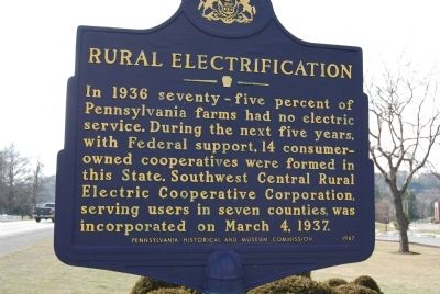
Rural Electrification
Erected 1987 by Pennsylvania Historical and Museum Commission.
Topics and series. This historical marker is listed in these topic lists: Agriculture • Industry & Commerce. In addition, it is included in the Pennsylvania Historical and Museum Commission, and the Rural Electrification 💡 series lists. A significant historical date for this entry is March 4, 1781.
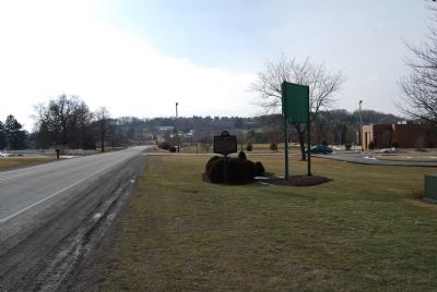
Location. 40° 37.971′ N, 79° 7.121′ W. Marker is near Indiana, Pennsylvania, in Indiana County. Marker is on Airport Road (Pennsylvania Route 1006) 0.2 miles east of Pennsylvania Route 286, on the left when traveling east. Located on the grounds of REA Energy, near the Indiana County Airport. Touch for map. Marker is at or near this postal address: 75 Airport Road, Indiana PA 15701, United States of America. Touch for directions.
Other nearby markers. At least 8 other markers are within 3 miles of this marker, measured as the crow flies. Walk of Fame (approx. 1.8 miles away); The Rescue of Anthony Hollingsworth (approx. 1.8 miles away); Memorial Park (approx. 2 miles away); James S. Nance, Jr. (approx. 2 miles away); Indiana County (approx. 2 miles away); James Maitland Stewart (approx. 2.1 miles away); The Catawba and Kittanning Native American Trails (approx. 2.2 miles away); William H. Sylvis (approx. 2.2 miles away). Touch for a list and map of all markers in Indiana.
Credits. This page was last revised on August 6, 2021. It was originally submitted on February 27, 2011, by Mike Wintermantel of Pittsburgh, Pennsylvania. This page has been viewed 567 times since then and 11 times this year. Photos: 1, 2. submitted on February 27, 2011, by Mike Wintermantel of Pittsburgh, Pennsylvania. • Bernard Fisher was the editor who published this page.

