The Promenade in Scottsdale in Maricopa County, Arizona — The American Mountains (Southwest)
The Spire
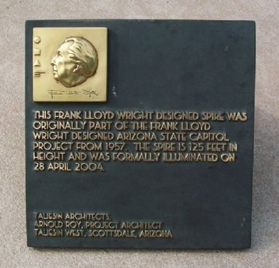
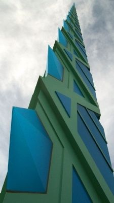
This Frank Lloyd Wright designed Spire was originally part of the Frank Lloyd Wright designed Arizona State Capitol project from 1957. The Spire is 125 feet in height and was formally illuminated on 28 April 2004.
Taliesin Architects.
Arnold Roy, Project Architect
Taliesin West, Scottsdale, Arizona
Erected 2004 by Taliesin West and City of Scottsdale.
Topics. This historical marker is listed in these topic lists: Architecture • Arts, Letters, Music. A significant historical date for this entry is April 28, 2004.
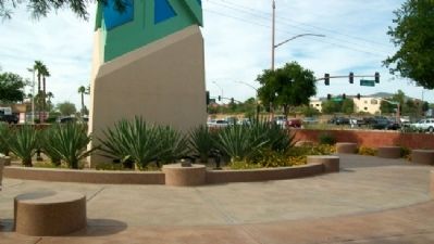
Location. 33° 38.259′ N, 111° 55.488′ W. Marker is in Scottsdale, Arizona, in Maricopa County. It is in The Promenade. Marker and Spire are in the Frank Lloyd Wright Commemorative Park, immediately southeast of the intersection of Scottsdale Road and Frank Lloyd Wright Boulevard, at The Promenade Shopping Center. Touch for map. Marker is at or near this postal address: 16427 North Scottsdale Road, Scottsdale AZ 85254, United States of America. Touch for directions.
Other nearby markers. At least 8 other markers are within 8 miles of this marker, measured as the crow flies. Frank Lloyd Wright and Arizona (a few steps from this marker); Taliesin West (approx. 5 miles away); National Memorial Cemetery of Arizona (approx. 6.7 miles away); Unidentified Veterans (approx. 6.7 miles away); Veterans Memorial Carillon (approx. 6.8 miles away); Merci Train Boxcar (approx. 6.9 miles away); Peoria Train Depot (approx. 7 miles away); Chief Washakie (approx. 7˝ miles away). Touch for a list and map of all markers in Scottsdale.
Also see . . . Arizona State Capitol Project. (Submitted on March 2, 2011, by William Fischer, Jr. of Scranton, Pennsylvania.)
Credits. This page was last revised on February 2, 2023. It was originally submitted on March 2, 2011, by William Fischer, Jr. of Scranton, Pennsylvania. This page has been viewed 1,267 times since then and 46 times this year. Photos: 1, 2, 3. submitted on March 2, 2011, by William Fischer, Jr. of Scranton, Pennsylvania.


