Shockoe Slip in Richmond, Virginia — The American South (Mid-Atlantic)
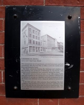
Commercial Block
1211-1217 East Cary Street
The Doric colonnade framing the doorways and windows on this building was produced in Richmond by Asa Snyder, who owned several ornamental iron companies during his career.
The partial cast-iron fronts of many of our 19th-century buildings were supplied by the well-known iron industry in Richmond. In addition to serving as a dignified and fairly economical facade, the fronts were believed to be a fireproof method of ornamentation.
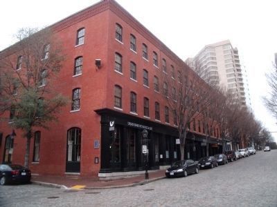
In the 19th and early 20th centuries, these buildings, like their neighbors, were storehouses for liquor, groceries, and tobacco: but from 1948 until the late 1970s they served as a barrel factory. Now the row has been renovated and converted to attractive office and retail space.
Topics. This historical marker is listed in this topic list: Industry & Commerce. A significant historical year for this entry is 1866.
Location. 37° 32.117′ N, 77° 26.033′ W. Marker is in Richmond, Virginia. It is in Shockoe Slip. Marker is at the intersection of East Cary Street (Virginia Route 147) and South 13th Street, on the right when traveling east on East Cary Street. Marker is on the northeast corner of the building. Touch for map. Marker is at or near this postal address: 1217 East Cary Street, Richmond VA 23219, United States of America. Touch for directions.
Other nearby markers. At least 8 other markers are within walking distance of this marker. Columbian Block (a few steps from this marker); 1300-1304 East Cary Street (a few steps from this marker); Bowers Brothers Coffee and Tea Building (within shouting distance of this marker); 1200 Block East Cary Street (within shouting distance of this marker); Powers-Taylor Building (within shouting distance of this marker); 1201 East Cary Street (about 300 feet away, measured in a direct line); The First Telephone Exchange South of the Potomac River (about 400 feet away); Black Hawk (1767-1838) (about 400 feet away). Touch for a list and map of all markers in Richmond.
More about this marker. On top is an early 20th-century photograph of the block courtesy of the Richard Cheek for Historic Richmond Foundation.
Also see . . .
1. Historic Shockoe Slip, Richmond. (Submitted on March 5, 2011.)
2. The Urban Farmhouse Market & Café. (Submitted on March 5, 2011.)
Credits. This page was last revised on February 1, 2023. It was originally submitted on March 5, 2011, by Bernard Fisher of Richmond, Virginia. This page has been viewed 570 times since then and 26 times this year. Photos: 1, 2. submitted on March 5, 2011, by Bernard Fisher of Richmond, Virginia.

