Glendale in Maricopa County, Arizona — The American Mountains (Southwest)
Stable / Granary
at Sahuaro Ranch…
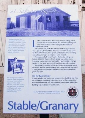
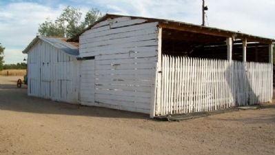
Little is known about the history of this building, which started out as a horse stable, but it almost certainly was one of the earliest work buildings to be erected at Sahuaro Ranch.
The eastern half, with the vertical wood siding, was built first - possibly before 1890. This was where the horses used by the Bartlett family, their guests, and employees - for riding and pulling carriages or wagons - were housed.
The western half, which has the horizontal siding, was built in 1935. By then the Smith family was raising more livestock - dairy cows and beef cattle - and needed a storage facility for the large amounts of feed these animals required.
Sometime in the late 1930s, the horses were moved out of the stable and the entire building was converted into a granary. A feed grinder was installed and bins were built to store the grain and feed.
On the Ranch Today
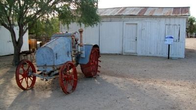
A grain grinder and feed mixer remain in the building, but they are no longer in working condition. Most of the storage bins have been removed, and the steel roof on the west end of the building was installed in recent years.
[Photo captions follow]
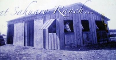
[Top] Looking southwest, the photograph above shows the building in 1899 when it was a horse barn. The corner of the Blacksmith Shop is visible to the left. (Photo courtesy of the Arizona Historical Foundation, W.N. Campbell Photograph Album, DW-84-24).
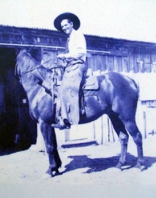
[Center left] This photograph of Bishop Patterson shows the building after it was converted into a granary in the 1930s. Patterson, a Glendale resident and local cotton gin operator, is on the east side of the building. (Photo courtesy of Richard Smith).
Erected by Glendale Parks & Recreation.
Topics. This historical marker is listed in these topic lists: Agriculture • Animals • Architecture. A significant historical year for this entry is 1890.
Location. 33° 34.624′ N, 112° 11.368′ W. Marker is in Glendale, Arizona, in Maricopa County. Marker is about 300 feet northwest of the Foreman's House, at Sahuaro Ranch Park Historic Area. Touch for map. Marker is at or near this postal address: 9802 North 59th Avenue, Glendale AZ 85302, United States of America. Touch for directions.
Other nearby markers. At least 8 other markers are within walking distance of this marker. Blacksmith and Machine Shop (a few steps from this marker); Corrals and Tack House (within shouting distance of this marker); The Barnyard (within shouting distance of this marker); Dairy Barn (within shouting distance of this marker); Well House (within shouting distance of this marker); Foreman's House (about 400 feet away, measured in a direct line); Fruit Packing Shed (about 600 feet away); Water & Power (about 600 feet away). Touch for a list and map of all markers in Glendale.
Credits. This page was last revised on August 30, 2020. It was originally submitted on March 5, 2011, by William Fischer, Jr. of Scranton, Pennsylvania. This page has been viewed 830 times since then and 16 times this year. Photos: 1, 2, 3, 4, 5. submitted on March 5, 2011, by William Fischer, Jr. of Scranton, Pennsylvania.
