Fort Davis in Southeast Washington in Washington, District of Columbia — The American Northeast (Mid-Atlantic)
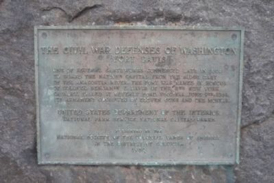
Fort Davis
Civil War Defenses of Washington
Erected 1956 by National Society of the Colonial Dames of America in the District of Columbia; National Park Service, U.S. Department of the Interior.
Topics and series. This historical marker is listed in these topic lists: Forts and Castles • War, US Civil. In addition, it is included in the Defenses of Washington, and the The Colonial Dames of America, National Society of series lists. A significant historical date for this entry is June 9, 1853.
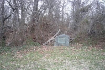
Location. 38° 51.989′ N, 76° 57.048′ W. Marker is in Southeast Washington in Washington, District of Columbia. It is in Fort Davis. Marker is on Alabama Avenue Southeast north of Pennsylvania Avenue Southeast, on the left when traveling north. Touch for map. Marker is at or near this postal address: 3812 Alabama Avenue Southeast, Washington DC 20020, United States of America. Touch for directions.
Other nearby markers. At least 8 other markers are within 2 miles of this marker, measured as the crow flies. A different marker also named Fort Davis (a few steps from this marker); Original Federal Boundary Stone, District of Columbia, Southeast 3 (approx. 0.3 miles away in Maryland); Fort DuPont (approx. 0.7 miles away); a different marker also named Fort DuPont (approx. 0.7 miles away); Original Federal Boundary Stone, District of Columbia, Southeast 2 (approx. 0.9 miles away in Maryland); First Rock Baptist Church (approx. 1.1 miles away); First Rock Baptist Church Rain Garden (approx. 1.1 miles away); Original Federal Boundary Stone, District of Columbia, Southeast 4 (approx. 1.2 miles away in Maryland). Touch for a list and map of all markers in Southeast Washington.
Also see . . .
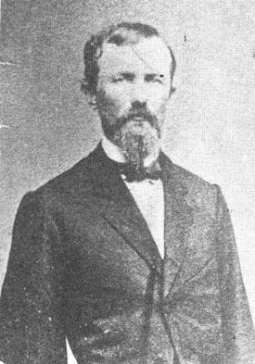
1. Benjamin Franklin "Grimes" Davis. (Submitted on March 5, 2011, by Richard E. Miller of Oxon Hill, Maryland.)
2. The Civil War Defenses of Washington: Fort Davis. National Park Service (Submitted on March 5, 2011, by Richard E. Miller of Oxon Hill, Maryland.)
Credits. This page was last revised on January 30, 2023. It was originally submitted on March 5, 2011, by Richard E. Miller of Oxon Hill, Maryland. This page has been viewed 1,111 times since then and 19 times this year. Photos: 1, 2, 3. submitted on March 5, 2011, by Richard E. Miller of Oxon Hill, Maryland. • Craig Swain was the editor who published this page.


