Glendale in Maricopa County, Arizona — The American Mountains (Southwest)
Irrigation
at Sahuaro Ranch…
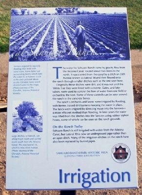
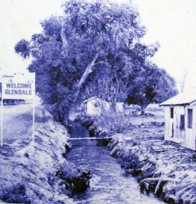
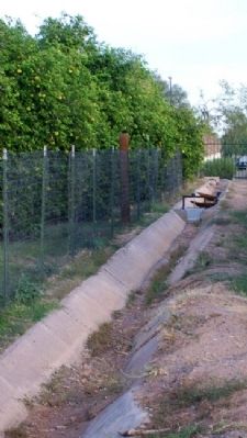
The water for Sahuaro Ranch came by gravity flow from the Arizona Canal, located about two miles to the north. It was carried from the canal by a ditch on 59th Avenue known as Lateral 18 and then flowed onto the ranch through smaller ditches such as the ones seen here.
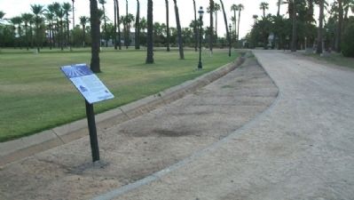
Originally these ditches were dirt, and it was not until the 1950s that they were lined with concrete. Gates, and later valves, were used to control the flow of water from one field or orchard to the next. Some of these controls can be seen around the ranch in the concrete boxes.
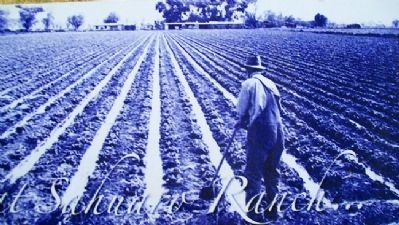
The ranch's orchards and lawns were irrigated by flooding, with berms (raised dirt barriers) keeping the water in place. The fields were irrigated by directing water into the furrow - a more efficient method than flooding. In later years the water was lifted from the ditches into the furrows using rubber siphon hoses, some of which can be seen on the ranch grounds.
On the Ranch Today
Sahuaro Ranch is still irrigated with water from the Arizona Canal, but Lateral 18 is now an underground pipe rather than an open ditch. Many of the irrigation ditches on the ranch have also been replaced by buried pipes.
[Photo captions follow]
[Top] Farmers irrigated by regularly flooding their fields with canal water. Some fields had surrounding berms which held the water in, or furrows (such as the ones pictured above on this Glendale farm) which directed water to the crops. (Photo courtesy of the Glendale, Arizona Historical Society).
[Center left] Large ditches, or laterals, ran along major roads and carried water south from the Arizona Canal. This was Lateral 16, which is now 43rd Avenue. (Photo courtesy of the Glendale, Arizona Historical Society).
Erected by Glendale Parks & Recreation.
Topics. This historical marker is listed in these topic lists: Agriculture • Waterways & Vessels.
Location. 33° 34.566′ N, 112° 11.242′ W. Marker is in Glendale, Arizona, in Maricopa County. Marker is about 75 feet southeast of the Fruit Packing Shed, at Sahuaro Ranch Park Historic Area. Touch for map. Marker is at or near this postal address: 9802 North 59th Avenue, Glendale AZ 85302, United States of America. Touch for directions.
Other nearby markers. At least 8 other markers are within walking distance of this marker. Orchards (a few steps from this marker); Fruit Packing Shed (within shouting distance of this marker); Welcome to Sahuaro Ranch (within shouting distance of this marker); Main House and Guest House (about 400 feet away, measured in a direct line); Foreman's House (about 400 feet away); Sahuaro Ranch Residence (about 500 feet away); Water & Power (about 500 feet away); Well House (about 500 feet away). Touch for a list and map of all markers in Glendale.
Also see . . .
1. SRP Canal History. (Submitted on March 6, 2011, by William Fischer, Jr. of Scranton, Pennsylvania.)
2. A Brief History of the Salt River Project. (Submitted on March 6, 2011, by William Fischer, Jr. of Scranton, Pennsylvania.)
Credits. This page was last revised on August 30, 2020. It was originally submitted on March 6, 2011, by William Fischer, Jr. of Scranton, Pennsylvania. This page has been viewed 1,034 times since then and 11 times this year. Photos: 1, 2, 3, 4, 5. submitted on March 6, 2011, by William Fischer, Jr. of Scranton, Pennsylvania.
