Near Tamarack in Calaveras County, California — The American West (Pacific Coastal)
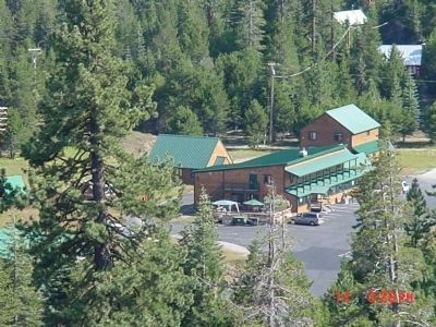
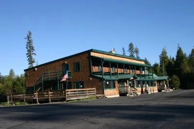
Camp Tamarack
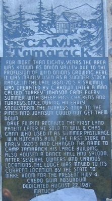
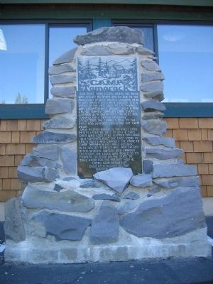
For more than 80 years, the area was known as Onion Valley due to the profusion of wild onions growing here. It was mainly used as a summer stock range. In the late 1860-70’s a sawmill was operated by C. Brown. Later a man called “Turkey” Johnson came every summer with sheep, pigs, chickens and turkeys. Once, during an early snowstorm, the turkeys took to the pines and Johnson could not get them down.
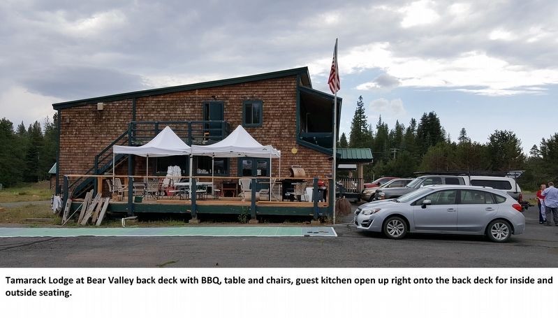
Dave Filipini received the first land patent. Later he sold to Will & Chas. Gann who used it as summer pasturage. W.H. Hutchins built the first store in early 20’s and changed the name to Camp Tamarck. His large building also housed a dance hall and saloon. After several owners and various locations, the lodge was moved to its current location by the State to make room for the present Hwy 4.
Erected 1987 by Matuca Chapter E Clampus Vitus, Credo Quia Absurdum, August 22, 1987.
Topics and series. This historical marker is listed in these topic lists: Notable Buildings • Notable Places • Settlements & Settlers. In addition, it is included in the E Clampus Vitus series list.
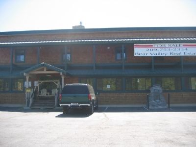
Location. 38° 26.336′ N, 120° 4.56′ W. Marker is near Tamarack, California, in Calaveras County. Marker is on Ebbetts Pass Scenic Byway (State Highway 4), on the right when traveling east. Tamarack is located in Calaveras County just west of the Alpine/Calaveras County Line. Marker is located in the parking area of the Camp Tamarack Lodge Bed & Breakfast. Touch for map. Marker is in this post office area: Arnold CA 95223, United States of America. Touch for directions.
Other nearby markers. At least 8 other markers are within 13 miles of this marker, measured as the crow flies. Harry Schimke (approx. 2.1 miles away); Old Emigrant Road (approx. 2.1 miles away); Reynold’s House (approx. 4.8 miles away); Bedrock Mortars (approx. 5 miles away); The Last Battle (approx. 10.6 miles away); Route of the Bartleson-Bidwell Party - 1841 (approx. 10.6 miles away); Sourgrass Bridge (approx. 11.2 miles away); Hermit Valley (approx. 12.1 miles away).
Regarding Camp Tamarack. Wikipedia Article:
Tamarack is a weather station in Alpine County, California which has been the site of United States meteorological records.
Tamarack has the snowfall record for one month. In January 1911, Tamarack received 390 inches (32.5 feet) of snow. It also set the US seasonal snow depth record of 454 inches (37.8 ft.)measured on March 10, 1911. During the winter of 1911 Tamarack was buried beneath a total of 767 inches (63.9 feet) of snow, most of which fell during that notorious January. Tamarack also holds the California seasonal snowfall record of 884 inches.
Tamarack is located on the west slope of the Sierra Nevada, at an elevation of about 7000 feet.
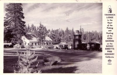
Photographed By Frasher Foto, circa 1940's
7. Tamarack Lodge
Description on postcard:
Tamarack Lodge
In the Heart of the Fishing and Hunting of the High Sierras on the Scenic Ebbetts Pass Highway, California
Note:
This photo shows the dance hall-saloon facing west. The old Highway 4 road bed can be seen in the photo. Click on photo to see details ie: the old Chevron Logo and gas pumps.
Credits. This page was last revised on October 21, 2021. It was originally submitted on October 1, 2008, by Syd Whittle of Mesa, Arizona. This page has been viewed 3,734 times since then and 32 times this year. Last updated on March 18, 2011, by Eric Polk of Lakewood, California. Photos: 1, 2, 3. submitted on October 1, 2008, by Syd Whittle of Mesa, Arizona. 4. submitted on October 1, 2018, by Victoria Bray-Johnson of Bear Valley, California. 5, 6. submitted on April 10, 2012, by Derek Bray of Tamarack, California. 7. submitted on September 10, 2009, by Syd Whittle of Mesa, Arizona.
