Fresno in Fresno County, California — The American West (Pacific Coastal)
Fresno
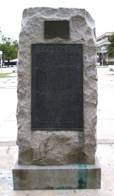
"Fresno" is the Spanish word for "Ash Tree." The first settlement to which the name was applied was "Fresno City," a station on the old Butterfield Stage Route located on Fresno Slough about one and one-half miles northwesterly from the present town of Tranquillity. This part of the San Joaquin Valley became known as the "Fresno Country." When the county was created in 1856 it was named Fresno although the county seat was established at Millerton, the site of which is now covered by the waters of Millerton Lake.
The Central Pacific Railroad reached here in 1872. Leland Stanford, one of the builders, was so impressed by two thousand acres of irrigated wheat growing on the nearby Easterby Rancho that he decided to establish a town at this site instead of at Sycamore Point on the San Joaquin River, near present day Herndon, as originally planned. In laying out the town the land for this park was set aside by the founders, to the people as a public square. Since the new town was the nearest rail point to Fresno City it was called "Fresno Station." At that time except for the lone wheat field there was nothing hereabout but empty desert. Not a tree was in sight and save for a lonely sheep camp where the courthouse now stands, there was no sign of human habitation. The echo of the hoof beats of the elk, antelope, and wild horse had scarcely died away from the place where you now stand.
The county seat was moved from Millerton to Fresno in 1874. The next year the first courthouse, substantially the central unit of the present building, was built on this site. Four acres around the courthouse were landscaped in 1878 and four years later the rest of the park was planted. In 1893 the two wings were added to the courthouse and a great new dome was erected. On the night of July 29, 1895, fire gutted the central portion of the building. Before the huge dome fell cascading streams of molten copper made a spectacle of unforgettable beauty. Within a year the damage was repaired and the present more modern dome was provided.
Today, as we enjoy the wide expanse of lawns and the cool shelter of these beautiful trees, it is well that we pause and contemplate the changes that a few score years have wrought, giving thanks for the pioneers whose vision made a desert into a garden.
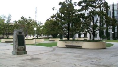
This marker, which originally stood in front of the old courthouse, to which it refers, still overlooks the site of that building, now standing over the spot which marked the center of the base of its Van Ness Avenue entrance steps. It was razed in 1966 upon completion of the new courthouse.
Erected
1954 by Fresno County Historical Society.
Topics. This historical marker is listed in these topic lists: Agriculture • Railroads & Streetcars • Settlements & Settlers • Waterways & Vessels. A significant historical date for this entry is July 29, 1862.
Location. 36° 44.194′ N, 119° 47.331′ W. Marker is in Fresno, California, in Fresno County. Marker is on the Fresno County Courthouse Plaza, about 50 feet northeast of the courthouse, and about 250 feet southwest of the intersection of M and Mariposa Streets. Touch for map. Marker is in this post office area: Fresno CA 93721, United States of America. Touch for directions.
Other nearby markers. At least 8 other markers are within walking distance of this marker. Dr. Martin Luther King, Jr. (about 300 feet away, measured in a direct line); Lao Hmong American War Memorial (about 300 feet away); Via Liberation (about 400 feet away); Fresno County Courthouse (about 400 feet away); David of Sassoon (about 400 feet away); Purple Heart Memorial (about 400 feet away); Honoring the Ex-Braceros and Their Contributions (about 500 feet away); William Saroyan (about 500 feet away). Touch for a list and map of all markers in Fresno.
Also see . . .
1. Fresno County, California. (Submitted on March 20, 2011, by William Fischer, Jr. of Scranton, Pennsylvania.)
2. Historical Fresno County Courthouse Park Walking Tour. (Submitted on March 20, 2011, by William Fischer, Jr. of Scranton, Pennsylvania.)
Credits. This page was last revised on September 8, 2020. It was originally submitted on March 20, 2011, by William Fischer, Jr. of Scranton, Pennsylvania. This page has been viewed 1,220 times since then and 43 times this year. Photos: 1, 2. submitted on March 20, 2011, by William Fischer, Jr. of Scranton, Pennsylvania.

