Seminary Hill in Alexandria, Virginia — The American South (Mid-Atlantic)
Fort Ward
Defenses of Washington
1861-1865
Fort Ward
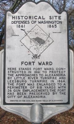
Here stands Fort Ward, constructed in 1861 to protect the approaches to Alexandria by Little River Turnpike and Leesburg Turnpike. In 1864, the fort was enlarged to a perimeter of 818 yards with 36 gun emplacements. The fort has been preserved by the City of Alexandria.
Erected by Civil War Round Table of Alexandria.
Topics and series. This historical marker is listed in these topic lists: Forts and Castles • War, US Civil. In addition, it is included in the Defenses of Washington series list. A significant historical year for this entry is 1861.
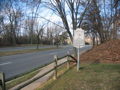
Location. 38° 49.741′ N, 77° 6.153′ W. Marker is in Alexandria, Virginia. It is in Seminary Hill. Marker is on West Braddock Road (County Route 420). Touch for map. Marker is at or near this postal address: 4301 West Braddock Road, Alexandria VA 22304, United States of America. Touch for directions.
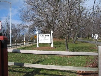
Other nearby markers. At least 8 other markers are within walking distance of this marker. Entrance Gate to Fort Ward/Officers' Hut (within shouting distance of this marker); a different marker also named Fort Ward (within shouting distance of this marker); African Americans and the Civil War (within shouting distance of this marker); "The Fort" and "Seminary" Community (about 300 feet away, measured in a direct line); Southwest Bastion (about 300 feet away); a different marker also named Fort Ward (about 400 feet away); Bombproof (about 400 feet away); Jackson Cemetery (about 400 feet away). Touch for a list and map of all markers in Alexandria.
More about this marker. In the center of the marker is a map of the Washington Defenses, with a red dot indicating the location of Fort Ward.
Related markers. Click here for a list of markers that are related to this marker. Fort Ward Virtual Tour by Markers
Also see . . .
1. Fort Ward Historic Site. (Submitted on May 8, 2008, by Craig Swain of Leesburg, Virginia.)
2. "A Tale of Two Communities And of How the Tale Gets Told." Washington Post March 15, 2009.
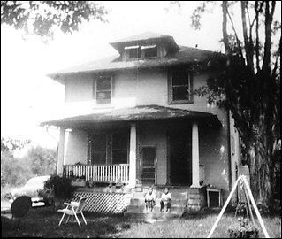
Article by Marc Fisher: "...residents trying to do what the city never did -- learn about those who lost out when Alexandria took these 44 acres across Braddock Road from Episcopal High School, reconstructed the old fort and made a park out of someone else's neighborhood. Now the city of Alexandria is trying to figure out Fort Ward's future: Should the park be used more intensively -- already, it's a site for big corporate picnics -- or protected as a site for reflection? And which story should the park and its museum tell -- that of the Civil War fort, or the Black community that called this home? ..." (Submitted on March 29, 2009, by Richard E. Miller of Oxon Hill, Maryland.)
Additional commentary.
1. Fort Ward Particulars
From Mr. Lincoln's Forts: A Guide to the Civil War Defenses of Washington, by Benjamin Franklin Cooling III and Walton H. Owen II:
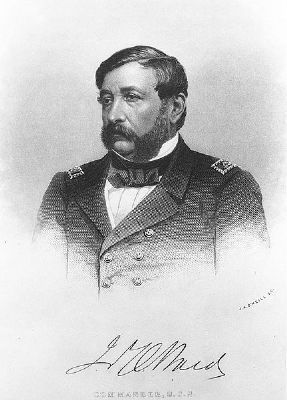
Named for Commander James Harmon Ward, killed in action at Mathias Point, on the Potomac River, June 27, 1861 (the first Federal naval officer killed in the war). The fort was started in September 1861.
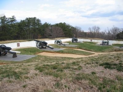
Originally the perimeter was 540 yards. Armament was five 32-pdr guns, six 24-pdr guns, and seven 10-pdr Parrott rifles. By December 1862, an additional battery of two 100-pdr Parrott Rifles was added. In January 1864, the fort was extended again, out to a perimeter of 818 yards. The armament was then listed as five 32-pdr guns, six 24-pdr guns, six 12-pdr guns, five 6-pdr guns, one 100-pdr Parrott, five 4.5in Ordnance rifles, one 10-pdr Parrott, seven 8-in siege mortars, and one 24-pdr Coehorn Mortar. Lastly, in February 1865, another upgrade of the armament was requested, adding six more 6-pdr guns, four 12-pdr howitzers, and six more 4.5in Ordnance rifles.
During the war, units garrisoning the fort included the 15th New York Engineers, 40th New York Infantry, 2nd New York Light Artillery, 3rd Battalion New York Artillery, 1st Connecticut Heavy Artillery (Companies L, C, F, and M), 166th Ohio National Guard (Companies B and C), Battery F Independent Pennsylvania Artillery, 1st New Hampshire Heavy Artillery, 4th Massachusetts Heavy Artillery (Companies F and M), 6th Pennsylvania Heavy Artillery (Companies C and M), 1st West Virginia Light Artillery (Battery C), and 13th New Jersey Infantry.
— Submitted March 1, 2008, by Craig Swain of Leesburg, Virginia.
Additional keywords. James Harman Ward, U.S. Navy
Credits. This page was last revised on January 27, 2023. It was originally submitted on March 1, 2008, by Craig Swain of Leesburg, Virginia. This page has been viewed 3,411 times since then and 179 times this year. Last updated on March 24, 2011, by Richard E. Miller of Oxon Hill, Maryland. Photos: 1, 2, 3, 4. submitted on March 1, 2008, by Craig Swain of Leesburg, Virginia. 5. submitted on March 29, 2009, by Richard E. Miller of Oxon Hill, Maryland. 6. submitted on March 24, 2011, by Richard E. Miller of Oxon Hill, Maryland.
