Staré Mesto in Praha, Czech Republic — Capital City Region (Historical Capital of Bohemia)
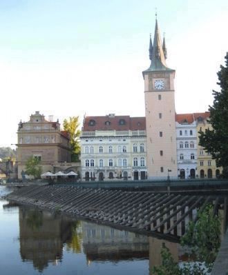
The Novotny Footbridge
Novotného Lavka
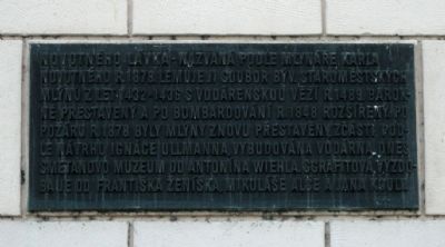
{Marker text in Czech:}
Novotného Lavka • Nazvaná mlynáře Karla Novotného R. 1878. Lemuje ji soubor býv. Staromĕstských mlýnu z let 1432-1436 s vodárenskou vĕží R. 1489, barokně prěstavěný a po a bombardování R. 1848 rožšířený. Po požáru .R. 1878 byly mlýny znovu přestavěny, zčásti podle návhru Ignáce Ullmanna, vybudována vodárna dnes Smetanova Muzeum od Antonína Wiehla, sgrafitová výzdoba je od Františka Ženíška, Mikuláše Alše a Jana Kouly.
Novotny Footbridge – named after the miller Karl Novotny in 1878. The Old Town mills date from the years 1432-1436, with the addition of a water tower in 1489. Rebuilt in the Baroque style after the 1848 bombardment, and expanded. After a fire in 1878, the Mills were rebuilt again, in part designed by Ignac Ullmann, with the water treatment plant (currently the Smetana Museum) by Antonin Wiehl, with sgraffito decoration [on the Museum] by Francis Zenisek, Nicholas Ales, and Jan Koula.
Topics. This historical marker is listed in this topic list: Notable Places. A significant historical year for this entry is 1878.
Location. 50° 5.124′ N, 14° 24.808′ E. Marker is in Praha. It is in Staré Mesto. Marker is on Novotného Lávka close to Smetanovo Nábř, on the right when traveling west. The Novotny Footbridge is located just south of the Charles Bridge, just off the Smetana Embankment, in the Old Town section of Prague. The marker is located on the south face of the Old Town Water Tower. Touch for map. Marker is in this post office area: Praha 222 220, Czech Republic. Touch for directions.
Other nearby markers. At least 8 other markers are within walking distance of this marker. Josef Mysliveček (within shouting distance of this marker); Church of St. Salvador (about 120 meters away, measured in a direct line); Johannes Kepler (about 120 meters away); Bohuslav Balbín (about 180 meters away); Francis Skaryna (approx. 0.2 kilometers away); Vojta Náprstek (approx. 0.3 kilometers away); Birthplace of Jaroslav Heyrovský (approx. 0.4 kilometers away); Franz Kafka (approx. half a kilometer away). Touch for a list and map of all markers in Praha.
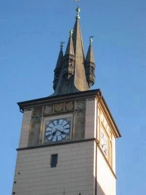
Also see . . . Old Town Water Tower. Prague.net's history of the Water Tower on the Footbridge, which has an interesting history in its own right: "...The first records about the tower (originally made of wood) date back to the beginning of the 15th century. As the workers in the tower used to use open fire to melt frozen water in the pipes during winter,

Photographed By Andrew Ruppenstein, August 24, 2009
2. The Novotny Footbridge and Marker - wide view
This is a view of the Novotného Lavka, or Novotny Footbridge, from the Smetana Embankment. In the foreground are the Vltava River and a weir (not the footbridge). "Footbridge" is not a mistranslation, but rather a misnomer, as it describes the structure jutting out into the river with several buildings on it - the former location of the Old Town mills, and later, waterworks. The marker is barely visible here, affixed to the lower right portion of the tower.

Photographed By Andrew Ruppenstein, August 24, 2009
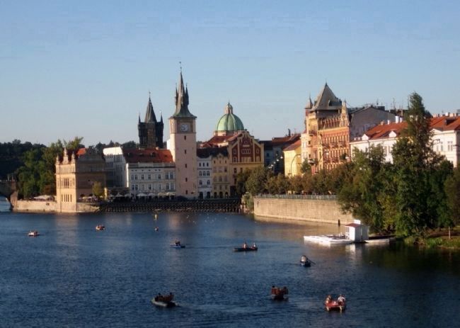
4. The Novotny Footbridge - wider view
Looking north up the Vltava River from the Legion Bridge at the Novotny Footbridge (the set of buildings jutting out into the river), and the Smetana Embankment (on the right). The left-most building visible on the Footbridge was once a mill, and then was converted to part of the city waterworks, but since 1936 has been the Bedrich Smetana Museum.
Credits. This page was last revised on February 10, 2022. It was originally submitted on March 29, 2011, by Andrew Ruppenstein of Lamorinda, California. This page has been viewed 976 times since then and 44 times this year. Photos: 1, 2, 3, 4. submitted on March 29, 2011, by Andrew Ruppenstein of Lamorinda, California. • Syd Whittle was the editor who published this page.

