LeRoy in Genesee County, New York — The American Northeast (Mid-Atlantic)
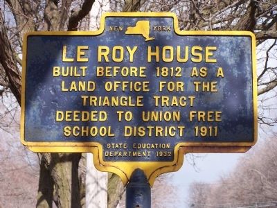
Le Roy House
Erected 1932 by New York State Education Departmentment.
Topics. This historical marker is listed in this topic list: Settlements & Settlers. A significant historical year for this entry is 1812.
Location. 42° 58.694′ N, 77° 59.126′ W. Marker is in LeRoy, New York, in Genesee County. Marker is on East Main Street (New York State Route 5) west of North Street, on the right when traveling west. Touch for map. Marker is at or near this postal address: 23 East Main, Le Roy NY 14482, United States of America. Touch for directions.
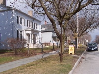
Other nearby markers. At least 8 other markers are within walking distance of this marker. The LeRoy House (a few steps from this marker); To Honor (within shouting distance of this marker); Town of LeRoy (about 300 feet away, measured in a direct line); Le Roy Civil War Memorial (about 400 feet away); Le Roy World War I Memorial (about 500 feet away); Ingham University Campus (about 600 feet away); Ingham University (about 800 feet away); Statue of Liberty Replica (approx. 0.2 miles away). Touch for a list and map of all markers in LeRoy.
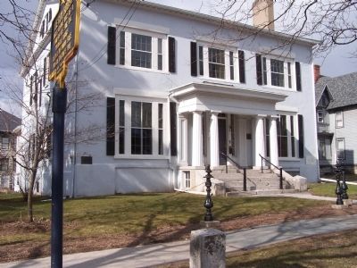
More about this marker. The Le Roy House is the location of the Le Roy Historical Society. The Jell-O Factory museum is located directly behind the house.
Regarding Le Roy House. The house was originally a land office, expanded in two stages during the 19th century by its builder, Jacob Le Roy, an early settler for whom the village is named. After the Revolutionary War, Robert Morris bought the land west of the Genesee River which now makes up Western New York from the state of Massachusetts. Most of this he later sold to the Holland Land Company, but in 1793 the New York firm of LeRoy & Bayard acquired 87,000 acres from him. Because of its shape, stretching from the current village of Le Roy to the shores of Lake Ontario and widening to the north, it was called the Triangle Tract.
Also see . . .
1. Le Roy Historical Society, Inc. (Submitted on April 10, 2011, by Bernard Fisher of Richmond, Virginia.)
2. Le Roy House and Union Free School. Wikipedia (Submitted on April 10, 2011, by Bernard Fisher of Richmond, Virginia.)
3. LeRoy House and Union Free School. National Register of Historic Places form, National Archives. (Submitted on September 18, 2023, by Anton Schwarzmueller of Wilson, New York.)
Credits. This page was last revised on September 18, 2023. It was originally submitted on April 8, 2011, by Pamela Scott of Brockport, New York. This page has been viewed 675 times since then and 31 times this year. Photos: 1, 2, 3. submitted on April 8, 2011, by Pamela Scott of Brockport, New York. • Bernard Fisher was the editor who published this page.


