Near Upperville in Fauquier County, Virginia — The American South (Mid-Atlantic)
Battle of Upperville
A Swirling Cavalry Fight
— Gettysburg Campaign —
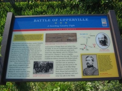
Two Northern and Southern cavalry brigades totaling about 6,000 men, with horse artillery supporting both sides, clashed all around you here across the Ayrshire and Kirkby farms on the afternoon of June 21, 1863. This was part of the Battle of Upperville, which took place as Confederate Gen. J.E.B. Stuart's cavalry division blocked the Federal horsemen as they attempted to locate Gen. Robert E. Lee's army, then marching into the Shenandoah Valley.
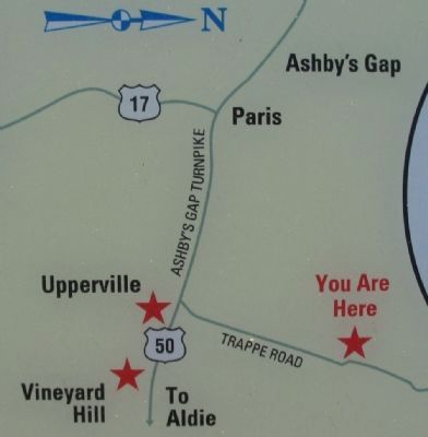
Three miles to the southeast, Stuart struggled to hold Vineyard Hill just east of Upperville long enough for Gen. William E. Jones's and Col. John R. Chambliss's brigades to pass by here and through the critical road junction of Trappe Road and Ashby's Gap Turnpike. As the two Confederate brigades fought for their lives in these fields and raced south, Union Gen. John Buford, with Col. William Gamble's and Col. Thomas C. Devin's brigades, charged over the fields from the east. The staunch Confederate defense thwarted the Federal attack and gave Jones and Chambliss and their men an opening to withdraw past this point to the lofty slopes of the Blue Ridge Mountains at Ashby's Gap near Paris. Stuart had succeeded in blocking the Federals, and Lee's army was safe in the Valley.
(Sidebar):
Called "Honest John" by his men, 37-year-old Gen. John Buford was deeply admired by them and respected by his adversaries. Ten days after the Trappe Road Fight, Buford attained the pinnacle of his career by holding the ridges west of Gettysburg until Union infantry arrived. Less than six months later, he was stricken with typhus and died in Washington, D.C.
Erected by Virginina Civil War Trails.
Topics and series. This historical marker is listed in this topic list: War, US Civil. In addition, it is included in the Virginia Civil War Trails series list. A significant historical month for this entry is May 1863.
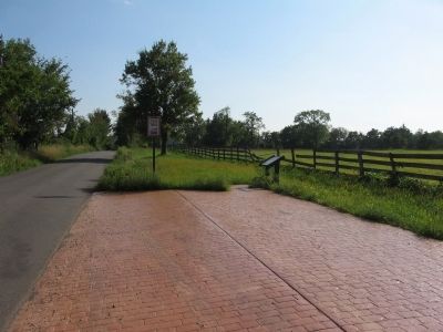
Location. 39° 0.524′ N, 77° 52.944′ W. Marker is near Upperville, Virginia, in Fauquier County. Marker is on Trappe Road (County Route 619), on the right when traveling south. Touch for map. Marker is in this post office area: Upperville VA 20184, United States of America. Touch for directions.
Other nearby markers.
At least 8 other markers are within 2 miles of this marker, measured as the crow flies. Lee Moves North Again (approx. one mile away); a different marker also named Battle of Upperville (approx. one mile away); This Stone (approx. one mile away); Mary Elizabeth Conover Mellon (approx. one mile away); The Upperville Library (approx. 1.1 miles away); The Armistead House (approx. 1.1 miles away); The Gibson House (approx. 1.1 miles away); The Smith House (approx. 1.2 miles away). Touch for a list and map of all markers in Upperville.
More about this marker. In the upper center is a sketch depicting the Battle of Upperville as seen from Union position, with Ashby's Gap in the distance, June 21, 1863. In the lower center is a photo of Col. William Gamble (seated, center) and staff. On the right are portraits of Gens. Jones and Buford.
Credits. This page was last revised on June 16, 2016. It was originally submitted on August 28, 2010, by Craig Swain of Leesburg, Virginia. This page has been viewed 1,784 times since then and 26 times this year. Last updated on April 12, 2011, by Jonathan Carruthers of Bealeton, Virginia. Photos: 1, 2, 3. submitted on August 28, 2010, by Craig Swain of Leesburg, Virginia.


