Near Sunset Crater Volcano National Monument in Coconino County, Arizona — The American Mountains (Southwest)
"The Peaks"
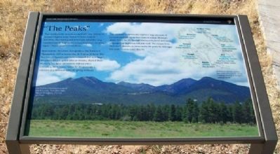
They dominate the horizon, rising 12,633 feet (3851 m) to Arizona's highest point. Visible for miles from all directions, they stand guard over a land which has long sustained people in spirit and natural resources. All of the region's Native peoples revere them.
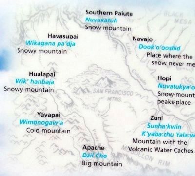
Spanish friars christened these peaks as San Francisco Mountain in 1629 to honor their St. Francis of Assisi. The first wave of Spanish explorers, surprised that such large mountains did not spawn lakes or streams, charted them the Sierra Sin Agua - mountains without water. Conversely, most Native names for the peaks are a reference to a mountain with life-giving moisture.
This immense stratovolcano captures large amounts of rain and snowfall, yet surface water is scarce. Moisture drains down rapidly through fractured bedrock and much is sponged up by porous volcanic rock. The closest river, the Little Colorado, is connected to the peaks by drainage but rarely receives water directly.
——————
[Background photo caption]
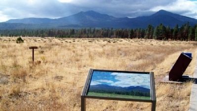
San Francisco Mountain is sculpted into four peaks, from left to right: Agassiz, Humphreys, Fremont, and Doyle.
[Upper right inset caption]
San Francisco Mountain bounded many traditional homelands and was a landscape shared by all the region's indigenous groups.
Erected by National Park Service.
Topics. This historical marker is listed in these topic lists: Anthropology & Archaeology • Environment • Exploration • Native Americans. A significant historical year for this entry is 1629.
Location. 35° 22.328′ N, 111° 33.337′ W. Marker is near Sunset Crater Volcano National Monument, Arizona, in Coconino County. The marker is at a pullout in the Coconino National Forest, outside the official national monument boundary, a little over a mile east of US Route 89 along the Sunset Crater Volcano/Wupatki Loop Road. Touch for map. Marker is in this post office area: Flagstaff AZ 86004, United States of America. Touch for directions.
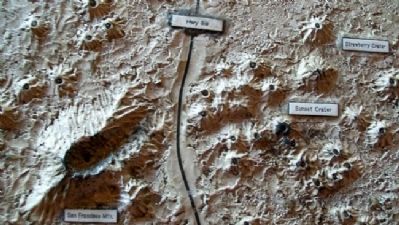
Other nearby markers. At least 8 other markers are within 12 miles of this marker, measured as the crow flies. Geological Infant (here, next to this marker); The Birth of a Mountain (approx. 2.2 miles away); Life and Landscape Transformed (approx. 2.3 miles away); The Power to Symbolize (approx. 2.3 miles away); As Powerful as a Volcano (approx. 2.3 miles away); Changes to Come (approx. 2.3 miles away); Bushmaster Park (approx. 11.1 miles away); The Museum Club (approx. 11.2 miles away). Touch for a list and map of all markers in Sunset Crater Volcano National Monument.
Also see . . .
1. Sunset Crater Volcano National Monument. (Submitted on April 13, 2011, by William Fischer, Jr. of Scranton, Pennsylvania.)
2. Sunset Crater Volcano Geology. (Submitted on April 13, 2011, by William Fischer, Jr. of Scranton, Pennsylvania.)
Credits. This page was last revised on June 16, 2016. It was originally submitted on April 13, 2011, by William Fischer, Jr. of Scranton, Pennsylvania. This page has been viewed 850 times since then and 7 times this year. Photos: 1, 2, 3, 4. submitted on April 13, 2011, by William Fischer, Jr. of Scranton, Pennsylvania.


