Wupatki National Monument in Coconino County, Arizona — The American Mountains (Southwest)
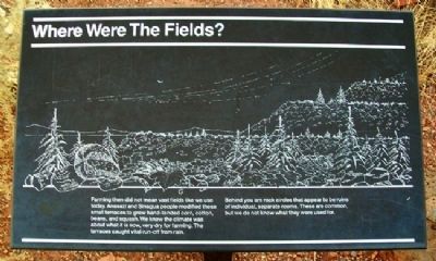
Where Were The Fields?
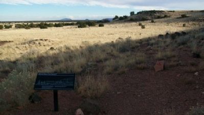
Farming then did not mean vast fields like we use today. Anasazi and Sinagua people modified these small terraces to grow hand-tended corn, cotton, beans, and squash. We know the climate was about what it is now, very dry for farming. The terraces caught vital run-off from rain.
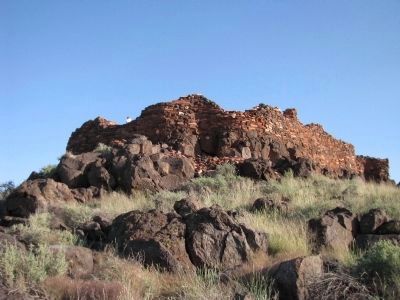
Behind you are rock circles that appear to be ruins of individual, separate rooms. These are common, but we do not know what they were used for.
Erected by National Park Service.
Topics. This historical marker is listed in these topic lists: Agriculture • Anthropology & Archaeology • Native Americans.
Location. 35° 33.956′ N, 111° 28.277′ W. Marker is in Wupatki National Monument, Arizona, in Coconino County. Marker is on the trail between Nalakihu Pueblo and Citadel Pueblo, west of the Loop Road. Touch for map. Marker is in this post office area: Flagstaff AZ 86004, United States of America. Touch for directions.
Other nearby markers. At least 8 other markers are within walking distance of this marker. Nalakihu (within shouting distance of this marker); The Citadel / Natural Features (within shouting distance of this marker); A Village/Abandonment (within shouting distance of this marker); Community (within shouting distance of this marker); A Legacy of the Past (approx. ¾ mile away); Box Canyon Ruins (approx. 0.8 miles away); Dry Land Farming (approx. 0.8 miles away); Ancient Landscapes (approx. 0.9 miles away). Touch for a list and map of all markers in Wupatki National Monument.
Also see . . . Wupatki National Monument. (Submitted on April 15, 2011, by William Fischer, Jr. of Scranton, Pennsylvania.)
Credits. This page was last revised on August 16, 2020. It was originally submitted on April 15, 2011, by William Fischer, Jr. of Scranton, Pennsylvania. This page has been viewed 790 times since then and 16 times this year. Photos: 1, 2. submitted on April 15, 2011, by William Fischer, Jr. of Scranton, Pennsylvania. 3. submitted on October 7, 2012, by Denise Boose of Tehachapi, California.


