Frederick in Frederick County, Maryland — The American Northeast (Mid-Atlantic)
Monocacy National Battlefield
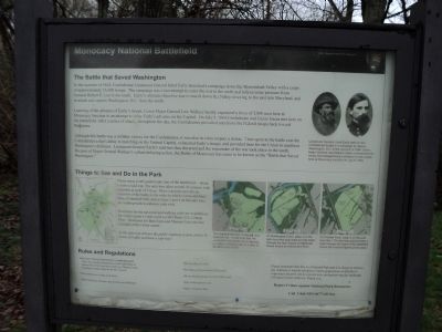
The Battle that Saved Washington
In the summer of 1864, Confederate Lieutenant General Jubal Early launched a campaign down the Shenandoah Valley with a corps of approximately 15,000 troops. The campaign was a last attempt to carry the war to the north and relieve some pressure from General Robert E. Lee in the south. Early’s ultimate objective was to march down the Valley, to swing to the east into Maryland, and to attack and capture Washington, D.C. from the north.
Learning of the advance of Early’s troops, Union Major General Lew Wallace hastily organized a force of 5,800 men here at Monocacy Junction in an attempt to delay Early’s advance on the Capital. On July 9, 1864 Confederate and Union forces met here on the battlefield. After a series of attacks throughout the day, the Confederates prevailed and drove the Federal troops back toward Baltimore.
Although this battle was a victory for the Confederates, it was also in a key respect a defeat. Time spent at the battle cost the Confederates a day’s delay in marching on the Federal Capital, exhausted Early’s troops, and provided time for the Union to reinforce Washington’s defenses. Lieutenant General Early’s raid was thus thwarted and the remainder of the war took place in the south. Because of Major General Wallace’s valiant delaying action, the Battle of Monocacy has come to be known as the “Battle that Saved Washington.”
Things to See and Do in the Park
Please enjoy a self-guided auto tour of the battlefield – about 6 miles round trip. The auto tour takes about 30 minutes with waysides at each of 5 stops. These waysides provide an overview of the battle in the order in which events unfolded. Here at Gambrill Mill, and at stops 3 and 4 on the auto tour, are walking trails to enhance your visit.
Erected by National Park Service.
Topics. This historical marker is listed in this topic list: War, US Civil. A significant historical month for this entry is July 1876.
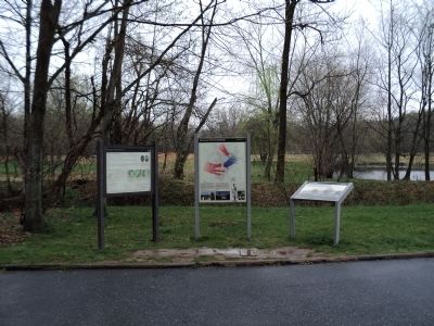
Location. This marker has been replaced by another marker nearby. It was located near 39° 22.045′ N, 77° 23.244′ W. Marker was in Frederick, Maryland, in Frederick County. Marker could be reached from Urbana Pike (Maryland Route 355), on the right when traveling north. Marker is located at the east end of the parking lot, near the trail head. Touch for map. Marker was in this post office area: Frederick MD 21704, United States of America. Touch for directions.
Other nearby markers. At least 8 other markers are within walking distance of this location. A Bold Plan (within shouting distance of this marker); Edgewood (about 300 feet away, measured in a direct line); Retreat (about 700 feet away); Burning the Bridge
(approx. 0.2 miles away); Desperate Escape (approx. 0.2 miles away); CPL Kirk J Bosselmann (approx. ¼ mile away); Caring for the River (approx. 0.3 miles away); a different marker also named A Bold Plan (approx. 0.3 miles away). Touch for a list and map of all markers in Frederick.
More about this marker. Portraits of Generals Early and Wallace appear at the top right of the marker. They have a caption of “Lieutenant General Jubal Early (left) led the Confederate forces in a campaign to capture Washington, D.C. in the summer of 1864. Union Major General Lew Wallace (right) commanded the troops that delayed Early’s advance on the capital here at Monocacy Junction on July 9, 1864.”
Below this are maps of three of the auto tour stops and the walking trails located at each. These have the following captions: “The Gambrill Mill trail to the left, is a relatively flat 1/2 –mile loop trail. An accessible boardwalk (in red above), provides a wooded path to a view of the Monocacy River.”; “At Worthington Farm, (stop 3 on the auto tour) two loop trails provide walks through the farm where Confederate forces forded the Monocacy River.”; and “At Thomas Farm, (stop 4 on the auto tour) the 1.75 loop trail provides a walk through the heart of the battlefield where the heaviest fighting took place.”
Also see . . . Monocacy National Battlefield. National Park Service website. (Submitted on April 23, 2011, by Bill Coughlin of Woodland Park, New Jersey.)
Credits. This page was last revised on January 8, 2023. It was originally submitted on April 23, 2011, by Bill Coughlin of Woodland Park, New Jersey. This page has been viewed 857 times since then and 14 times this year. Photos: 1, 2. submitted on April 23, 2011, by Bill Coughlin of Woodland Park, New Jersey.

