Sharon in Litchfield County, Connecticut — The American Northeast (New England)
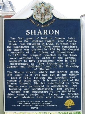
Sharon
The Sharon Green, where this marker stands, still much as it was laid out in the wilderness in 1739, reflects the foresight and wisdom of those men. It is now a part of the Sharon Historic District established in 1975. Sharon once prospered in agriculture, iron founding, and manufacturing. Her products ranged from mousetraps to the Hotchkiss rifled cannon projectile. Except for farming, the old industries have now almost vanished.
Erected by the Town of Sharon
the Sharon Historical Society
and the Connecticut Historical Commission
1978
Erected 1978 by the Town of Sharon, the Sharon Historical Society, and the Connecticut Historical Commission.
Topics. This historical marker is listed in these topic lists: Colonial Era • Settlements & Settlers. A significant historical year for this entry is 1732.
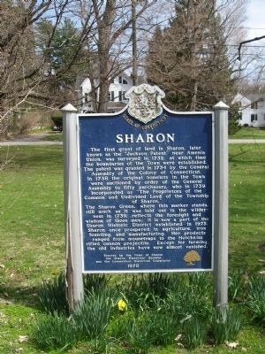
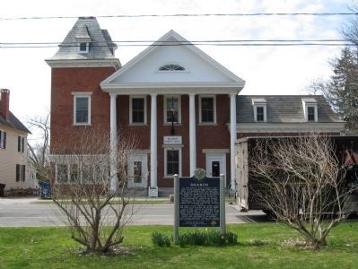
Location. 41° 52.709′ N, 73° 28.611′ W. Marker is in Sharon, Connecticut, in Litchfield County. Marker is at the intersection of Main Street and West Main Street, on the left when traveling south on Main Street. Located on the Sharon Green, across from Sharon Town Hall. Touch for map. Marker is in this post office area: Sharon CT 06069, United States of America. Touch for directions.
Other nearby markers. At least 8 other markers are within 5 miles of this marker, measured as the crow flies. Site of the 2nd House of Worship (within shouting distance of this marker); Sharon Clock Tower (approx. 0.2 miles away); Sharon Veterans Monument (approx. 0.2 miles away); Dedicated to the Men and Women of Sharon (approx. 0.2 miles away); Sharon Soldiers' Monument (approx. 0.2 miles away); Dutchess County (approx. 1.4 miles away in New York); Troutbeck (approx. 2.6 miles away in New York); Amenia (approx. 4.2 miles away in New York). Touch for a list and map of all markers in Sharon.
Regarding Sharon. Sharon is named after the Plain of Sharon, in Israel
Also see . . .
1. Town of Sharon. (Submitted on May 2, 2011, by Michael Herrick of Southbury, Connecticut.)
2. Sharon, Connecticut on Wikipedia. (Submitted on May 2, 2011, by Michael Herrick of Southbury, Connecticut.)
Credits. This page was last revised on June 16, 2016. It was originally submitted on May 2, 2011, by Michael Herrick of Southbury, Connecticut. This page has been viewed 629 times since then and 14 times this year. Photos: 1, 2, 3. submitted on May 2, 2011, by Michael Herrick of Southbury, Connecticut.


