Clarks Hill in McCormick County, South Carolina — The American South (South Atlantic)
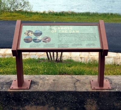
Purpose of the Dam
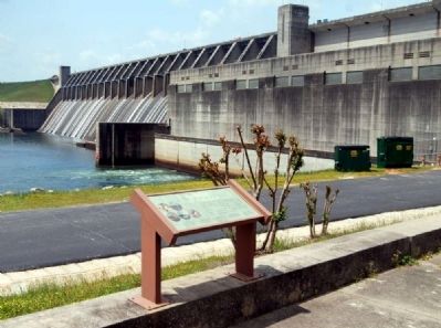
The devastating flood of 1888 was one of several along the Savannah River in the 1800s. Altogether, they prompted the decision to build the Clarks Hill Dam and Lake, renamed the J. Strom Thurmond Dam and Lake in 1987. Authorized by the Flood Control Act of 1944, and constructed between 1946 and 1954, this multipurpose project today controls flooding, improves navigation on the Savannah River, generates hydropower, provides recreation, and fish and wildlife management opportunities.
1. In 1888, the 900 block of Broad Street flooded, which damaged much of downtown Augusta and dramatically impacted citizens.
2. Downtown Augusta, with its riverside commercial and recreational development, such as the Riverwalk, has benefited from the dam's flood control.
3. Thurmond Dam is one of 75 hydroelectric dams owned and operated by the U.S. Army Corps of Engineers. The Corps produces about a quarter of the nation's hydroelectric power.
4. Thurmond Lake offers a variety of outdoor recreation activities in both Georgia and South Carolina.
5. Since the dam was completed, the lake and its surroundings have attracted a diversity of animal life.
Erected by U.S. Army Corps of Engineers.
Topics. This historical marker is listed in these topic lists: Disasters • Man-Made Features • Waterways & Vessels. A significant historical year for this entry is 1888.
Location. 33° 39.6′ N, 82° 11.783′ W. Marker is in Clarks Hill, South Carolina, in McCormick County. Marker is located near the Power Plant Park. Touch for map. Marker is in this post office area: Clarks Hill SC 29821, United States of America. Touch for directions.
Other nearby markers. At least 10 other markers are within 11 miles of this marker, measured as the crow flies. Thurmond Dam and Lake / McCormick County (approx. 0.3 miles away); J. Strom Thurmond Dam (approx. 0.4 miles away); Damascus Baptist Church (approx. 7 miles away in Georgia); Jabez Pleiades Marshall (approx. 7.9 miles away in Georgia); Bridging Time (approx. 9.8 miles away); a different marker also named Bridging Time (approx. 9.8 miles away); First Baptist Church in Georgia (approx. 10.3 miles away in Georgia); Religious Liberty in Georgia (approx. 10.3 miles away in Georgia); Columbia County (approx. 10˝ miles away in Georgia); Woodmen of the World Veterans Monument (approx. 10˝ miles away in Georgia). Touch for a list and map of all markers in Clarks Hill.
Also see . . .
1. J. Strom Thurmond Dam. J. Strom Thurmond Dam, also known in Georgia as Clarks Hill Dam, is a concrete-gravity and embankment dam located 22 miles (35 km) north of Augusta, Georgia on the Savannah River at the border of South Carolina and Georgia, creating Lake Strom Thurmond. (Submitted on May 3, 2011, by Brian Scott of Anderson, South Carolina.)
2. Lake Strom Thurmond. Lake Strom Thurmond, known in Georgia as Clarks Hill Lake, is a reservoir at the border between Georgia and South Carolina in the Savannah River Basin (Submitted on May 3, 2011, by Brian Scott of Anderson, South Carolina.)
Credits. This page was last revised on November 22, 2020. It was originally submitted on May 3, 2011, by Brian Scott of Anderson, South Carolina. This page has been viewed 762 times since then and 14 times this year. Photos: 1, 2, 3, 4, 5, 6, 7, 8. submitted on May 3, 2011, by Brian Scott of Anderson, South Carolina.
