Northwestern Precinct in Saint Paul in Ramsey County, Minnesota — The American Midwest (Upper Plains)
Rice Park
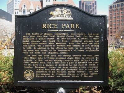
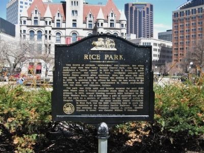
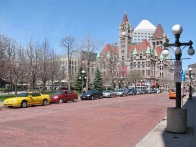
The scene of circuses, celebrations, and concerts, and seven years older than New York's famous Central Park, this land was designated a "public square" in 1849 by John R. Irvine, a territorial pioneer, and Henry M. Rice, territorial delegate and United States senator after statehood. Rice, for whom the park was named, was a native of Vermont who arrived at Fort Snelling in 1839. In addition to the offices he held, he was active in the fur trade and served as an intermediary in treaty negotiations with the Sioux and Chippewa Indians.
The park was little used and largely uncared for until 1860 when Mayor John S. Prince procured shade trees to enhance the grounds. In 1872, summer evening concerts were initiated by the Great Western Band, and a year later a pair of squirrels was given for the park as a gesture of goodwill by the chief of police in Memphis, Tennessee. Among the many notable events celebrated in Rice Park was the 1883 reception held to mark the completion of the Northern Pacific Railroad. The fete was attended by President Chester A. Arthur, General Ulysses S. Grant, and General William T. Sherman.
Erected 1969 by the City Planning Board of St. Paul.
Topics and series. This historical marker is listed in this topic list: Parks & Recreational Areas. In addition, it is included in the Former U.S. Presidents: #21 Chester A. Arthur series list. A significant historical month for this entry is June 1969.
Location. 44° 56.675′ N, 93° 5.825′ W. Marker is in Saint Paul, Minnesota, in Ramsey County. It is in Northwestern Precinct. Marker can be reached from West 4th Street west of North Market Street, on the right when traveling west. Touch for map. Marker is at or near this postal address: 109 West 4th Street, Saint Paul MN 55102, United States of America. Touch for directions.
Other nearby markers. At least 8 other markers are within walking distance of this marker. Market Street Methodist Episcopal Church (within shouting distance of this marker); The Saint Paul Public Library (within shouting distance of this marker); The James J. Hill Reference Library (within shouting distance of this marker); George Latimer Central Library (about 300 feet away, measured in a direct line); Legacy of Leadership (about 500 feet away); Giants populate the earth (about 700 feet away); Hamm's Bear (approx. 0.2 miles away); History of Saint Paul (approx. 0.3 miles away). Touch for a list and map of all markers in Saint Paul.
Also see . . . The Story of Rice Park. Streets MN website entry (Submitted on December 31, 2021, by Larry Gertner of New York, New York.)
Credits. This page was last revised on February 12, 2023. It was originally submitted on May 9, 2011, by Keith L of Wisconsin Rapids, Wisconsin. This page has been viewed 1,756 times since then and 63 times this year. Photos: 1, 2, 3, 4, 5, 6, 7, 8, 9, 10. submitted on May 9, 2011, by Keith L of Wisconsin Rapids, Wisconsin.
