Gaffney in Cherokee County, South Carolina — The American South (South Atlantic)
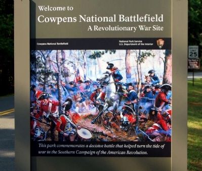
Welcome to Cowpens National Battlefield
A Revolutionary War Site
This park commemorates a decisive battle that helped turn the tide of war in the Southern Campaign of the American Revolution.
Erected by National Park Service, U.S. Department of the Interior.
Topics. This historical marker is listed in these topic lists: Colonial Era • War, US Revolutionary.
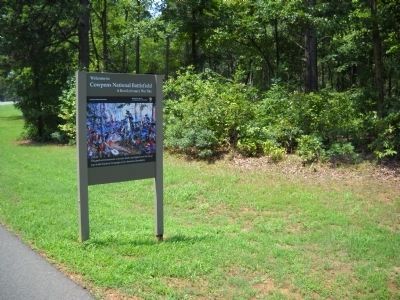
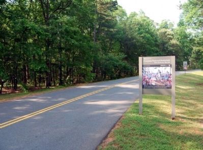
Location. 35° 8.49′ N, 81° 48.967′ W. Marker is in Gaffney, South Carolina, in Cherokee County. Marker is on Piedmont Road south of Chesnee Highway (South Carolina Highway 11), on the right when traveling south. Touch for map. Marker is in this post office area: Gaffney SC 29341, United States of America. Touch for directions.
Other nearby markers. At least 10 other markers are within walking distance of this marker. After Victory (approx. ¼ mile away); Morgan's Flying Army (approx. 0.3 miles away); Spirit up the People (approx. 0.3 miles away); U.S. Memorial Monument (approx. 0.3 miles away); Battle of Cowpens Monument (approx. 0.3 miles away); The Battle of Cowpens: Prelude to Victory (approx. 0.3 miles away); The Cavalry (Dragoons) at Cowpens (approx. 0.4 miles away); Race to the Dan River (approx. 0.4 miles away); The Continental Army at Cowpens (approx. half a mile away); Washington Light Infantry Monument (approx. half a mile away). Touch for a list and map of all markers in Gaffney.
Also see . . .
1. Cowpens National Battlefield (U.S. National Park Service). A pasturing area at the time of the battle, this Revolutionary War site commemorates the place where Daniel Morgan and his army turned the flanks of Banastre Tarleton's British army. (Submitted on May 22, 2011, by Brian Scott of Anderson, South Carolina.)
2. Cowpens National Battlefield. Cowpens National Battlefield or Cowpens National Battlefield Park is a unit of the National Park Service just east of Chesnee, South Carolina, not far from the North Carolina state line. (Submitted on May 22, 2011, by Brian Scott of Anderson, South Carolina.)
3. Cowpens National Battlefield. During the American Revolution, the Battle of Cowpens, January 17, 1781, played an important part in the chain of events that led to the climax of the war at Yorktown. (Submitted on May 22, 2011, by Brian Scott of Anderson, South Carolina.)
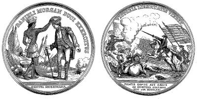
4. Battle of Cowpens. The Battle of Cowpens (January 17, 1781) was a decisive victory by American Revolutionary forces under Brigadier General Daniel Morgan, in the Southern campaign of the American Revolutionary War. (Submitted on May 22, 2011, by Brian Scott of Anderson, South Carolina.)
5. The Battle of Cowpens. Fought on the South Carolina border with North Carolina, United States of America. (Submitted on May 22, 2011, by Brian Scott of Anderson, South Carolina.)
6. The Patriot Resource: Battle of Cowpens. New Southern Commander Maj. General Nathanael Greene determined that he needed time to rehabilitate his army. (Submitted on May 22, 2011, by Brian Scott of Anderson, South Carolina.)
7. Cowpens National Battlefield Existing Conditions Report. Cowpens National Battlefield was established on March 4, 1929, "…in order to preserve that part of the Cowpens battle grounds near Ezells, Cherokee County, South Carolina, where General Daniel Morgan, commanding, participated in the Battle of Cowpens on the 17th day of January, 1781, the Secretary of War be, and he is hereby authorized and directed to acquire, by gift, not more than one acre of land on which he shall erect or cause to be erected a suitable monument to commemorate said battle.” (Submitted on May 23, 2011, by Brian Scott of Anderson, South Carolina.)
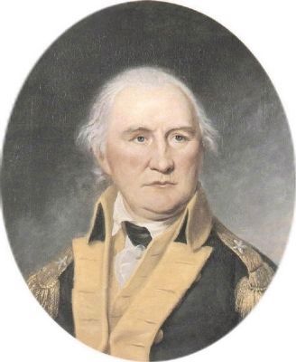
8. Daniel Morgan. Daniel Morgan (1736 – July 6, 1802) was an American pioneer, soldier, and United States Representative from Virginia. (Submitted on May 23, 2011, by Brian Scott of Anderson, South Carolina.)
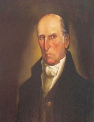
9. Andrew Pickens. Andrew Pickens (September 13, 1739 – August 11, 1817) was a militia leader in the American Revolution and a member of the United States House of Representatives from South Carolina. (Submitted on May 23, 2011, by Brian Scott of Anderson, South Carolina.)
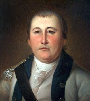
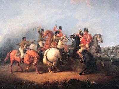
10. William Washington. William Washington (February 28, 1752 to March 6, 1810), was an officer of the Continental Army during the American Revolutionary War, who held a final rank of Brigadier General in the newly created United States after the war. (Submitted on May 23, 2011, by Brian Scott of Anderson, South Carolina.)
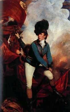
11. Banastre Tarleton. General Sir Banastre Tarleton, 1st Baronet, GCB (21 August 1754 – 16 January 1833) was a British soldier and politician. (Submitted on May 23, 2011, by Brian Scott of Anderson, South Carolina.)
12. Pincer Movement. The pincer movement or double envelopment is a military maneuver. (Submitted on May 23, 2011, by Brian Scott of Anderson, South Carolina.)
13. Cowpens National Battlefield, National Park Service. (Submitted on August 31, 2019.)
Additional commentary.
1. Cowpens National Battlefield
Description
Cowpens National Battlefield Site (800 acres) is at an elevation of 934 feet in gently rolling terrain. With the exception of houses ands vegetation, the area is much like it was when the battle was fought. Soils are sandy loam and a light red clay. Drainage is good and there are few outcrops. The climate is typical of the southern Piedmont.
During
the five years from 1972 until December 1977, an ongoing land acquisition program has purchased approximately 787 acres in compliance with a legislative mandate to expand the battlefield from less than 3 to over 800 acres. When land acquisition is complete the Battlefield will include 842.9 acres. Of this acreage, approximately 175 acres form the historic core - it is this irregularly shaped area that will be nominated to the National Register. The remaining 680 acres will contain park residences, maintenance areas, environmental education facilities, and will be managed to preserve its natural appearance.
Within the proposed 843 acres of the park were eight pre-1900 structures. Of these only one meets the National Register criteria, relates to the main theme of the historic area, and is within the historic core area. The remainder do not qualify and have been, or will be, removed after compliance with 36 CFR 800.
The vegetative cover of the battlefield reflects man's use of the land. Cattle were grazed in the area beginning in the last half of the 18th century until ultimately it was overgrazed. During the second quarter of the 19th century, large tracts of forest were clear-cut for agricultural use. Beginning about 1890, and lasting until the early 1930's, the land was in cotton until it became so depleted as to no longer support a cash crop. Today approximately
one-third of the core area is in woods and one-third of the remaining acreage is under cultivation and the remainder is pasture, orchards, or occupied by structures. The wooded areas range from pine plantations to nearly pure hardwood stands. Presently the area is criss-crossed by roads.
At the time of the Battle of Cowpens in January 1781, there were no settlers living in the vicinity. The name, Hannah's Cowpens, referred to the use of the area as a holding place for cattle, but the nearest man-made structures were some 2 miles away from the battle area. The area where the battle was fought was an open, mature hardwood forest with red, post, and white oak predominating. There was little undergrowth and it was possible to see movement of men at a distance of 500 yards. Cattle browsed on the grasses that carpeted the forest floor. Two roads traversed the area. Running north and south the Green River (Mill Gap) Road followed the watershed between the Broad and the Pacolet Rivers and gradually ascended to intersect with the road leading from Coulter's Ford on the Pacolet River to Island Ford on the Broad River. This intersection was 600 yards northwest of Morgan's command post, and outside of the historic core area. The Green River Road continued on, following the Little Buck and Horse Creek watershed, while the road to Island Ford followed the Horse-Buck Creek divide. The
road to Coulter's Ford crossed Little Buck Creek and ran along the watershed between Little River and Island Creek.
During the next 40 years it is proposed to restore the historic area to its appearance at the time of the battle. The vegetation will be restored through reforestation and selective cutting of existing forested areas. The Green River Road will be returned to its 1781 appearance. All other existing roads will be obliterated and regarded to a natural contour.
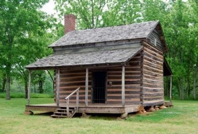
The Robert Scruggs House (CP-1), located within the historic core area, was constructed in 1828 with frame additions added at various times during the ext 60 years. Architectural investigation in 1975-76 revealed that the original log structure was substantially intact and had retained much of its integrity. Based on this information, it was decided to return the house to its appearance circa 1830. In June 1977, a Section 106 statement outlining this work was approved by the Advisory Council on Historic Preservation.
The Robert Scruggs House was a 1 1/2 story, 1-room cabin, resting on dry-laid stone piers. It has a shingled gable roof. The gables of the house were enclosed with beaded lap siding. The brick chimney on the east and rests on a stone base. The original cabin measured approximately 16x20 feet with doors on the north and south sides. There is a window on the east end
next to the fireplace and a window on the west gable. A stairway to the loft is in the southeast corner of the room. The cabin has beaded ceiling joists.
In addition to the Scruggs House, the historic core of the National Battlefield also contains two monuments or memorials to the battle, and the historic Green River Road.
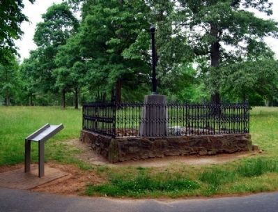
Washington Light Infantry Monument (CP-4) - Erected April 22, 1856, it was described as follows: "On a solid stone foundation rises an octagonal base of concrete, composed of shell and sand from Fort Moultrie. Capping this is an 8-sided slab of white marble from which springs a cast iron shaft, surmounted by an English bombshell, on which is perched a golden eagle." Since this description of the monuments original appearance, it has been vandalized through the years. The eagle is no longer present not the 30' iron fence that once surrounded it. At the base is a small granite block with an inscription plate on the front. The entire monument is surrounded by a 1' high natural stone wall. The height of the monument is approximately 10'. several objects were placed inside the monument: a bottle of water from Eutaw Springs, a brick from the house at Eutaw Springs where the British took refuge, a roll of the officers and men in the Washington Light Infantry who participated in the expedition, and a pamphlet describing the Cowpens Battle. The
monument stands on an acre of land about 300 feet south of the 32' granite monument erected by the War Department.
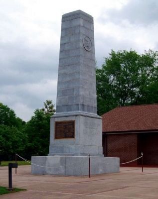
War Department of United States Monument (CP-6) - Erected in 1932, the War Department Monument is a granite shaft 32 feet high and 7 feet square. The base of the monument is 11'4" square and is also made of granite. On the north face of the monument at a height of 25 feet there is a seal that is approximately 3 feet in diameter. There are inscriptions on the north and south faces of the monument and commemorative plaques on the east and west faces.
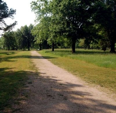
Green River (Mill Gap) Road (No. HS-5) - A narrow, well-used road, used by both the American and the British forces during the Cowpens Battle. It appears sandy with plant growth in places. The road will be restored to its 1781 appearance and closed to traffic.
Richard Scruggs Chimney and Foundation - Richard Scruggs' log cabin was built on the Long Branch of Island Creek about 1811, a date confirmed by deeds in the Spartanburg County Courthouse. The chimney and a few foundation stones remain in place since a 1950s fire destroyed the cabin. The 1974 Historic Grounds and Resource Study for Cowpens National Battlefield noted a stone in the chimney instructed "R.S. 17 1811." Stabilization work on the chimney was done in 1978. The top of the flue was rebuilt, a new lintel
was put in, and the chimney was repointed due to the collapse of the original mortar. The chimney is constructed of field stones and mortar, is of Tidewater design, and measures approximately 9 feet wide, 20 feet tall and 4 1/2 feet thick. The hearth measures 50 inches x 75 inches. a 6 inch x 8 inch x 100 inch hardwood lintel runs across the top of the hearth and is built into the chimney. The chimney's significance is based on its Tidewater design, large overall size and large firebox (hearth). These features make the structure a unique remnant of 19th century architecture found very few places in the Southeast.
Significance
During the American Revolution, the Battle of Cowpens, January 17, 1781, played an important part in the chain of events that led to the climax of the war at Yorktown. Cowpens was the second American victory in the Southern Campaign of the Revolution during a 3-month period. Depressed by 2 years of defeat and persecution, these two victories within 3 months of each other served to strengthen the Patriots' resolve.
On October 7, 1780, the British were set back at Kings Mountain. American riflemen destroyed a Tory force under Major Patrick Ferguson. General Cornwallis, 30 miles away, suddenly felt his army was exposed and pulled back to Winnsboro, South Carolina. There he got word that the new American Army Commander in the South, General Nathaniel Greene, had divided his army. A detachment was led by Brigadier General Daniel Morgan. In dividing an inferior army in the presence of the enemy, Greene had violated a basic military rule, and at least in theory, exposed his divided forces to being beaten in detail. Cornwallis thus divided his forces and sent Colonel Banastre Tarleton to overtake Morgan while his main force moved to get between Greene and Morgan and cut off the latter's retreat.
Upon learning of the British approach, Morgan moved north near Broad River, stopping 8 miles short of a place called Cowpens, because it was a winter pasture and gathering area well known to other Patriots who were hastening to reinforce his command. The position Morgan had chosen lay astride the Green River (or Mill Gap) Road. On the left or northeast of the position was a boggy area where Suck Creek #2 begins. To the southwest were Maple Swamp and the headwaters of Long Branch of Island Creek. In order to turn Morgan's flanks the British would have had to pass those bogs which recent rains had made more treacherous. The ground was slightly undulated and covered with an open forest of oak, hickory and pine.
On the morning of January 17, 1871, Tarleton struck the positions that Morgan had moved into the night before. On the morning of the 17th, General Morgan deployed his men in two liens with the militia units to the front and his Continental Troops in a second line behind. His cavalry was held in reserve. The British advance was met with brief resistance from the militia who then retreated as instructed to a point to the rear of the Continentals. The British pressed forward and saw the Continental line retreat. Believing victory was theirs, they charged on, to be caught in a double envelopment, as the cavalry struck Tarleton's right and the reformed militia hit the left. The result was total victory as only 200 of the 1,100 British troops escaped. News of the victory heartened the Americans and inflicted severe losses of men on the British. British military activity in the south would continue another 9 months before ending with the surrender at Yorktown, Virginia.
The approved Master Plan calls for all modern improvements to be removed from the historical core area. The Green River Road will be restored to its 1781 appearance. All other roads existing within the area have been, or will be, removed and graded back to natural contours. efforts will also be made to restore the landscape to its earlier appearance of an open forest.
Cowpens National Battlefield and, more particularly, the historic core will increasingly reflect the conditions that existed on that day in mid-January when General Morgan totally defeated the British forces and heartened the Patriots' resolve and brought the war one step closer to its conclusion at Yorktown in October of that year.
The Robert Scruggs House, though built nearly 50 years after the battle, has a close association with the battleground. From 1849, when Historian-Illustrator Benson J. Lossing stopped and chatted with Robert Scruggs, through the visits of other historians and military personnel interested in the battle, to the 1970's, students of the battle have paused at the Scruggs house to get directions, discuss the battle and orient themselves. Because of its age and the role of three generations as information sources for the battlefield, the house is linked to the main theme of the nomination. (Source: National Register Nomination Form.)
— Submitted May 22, 2011, by Brian Scott of Anderson, South Carolina.
Credits. This page was last revised on February 15, 2022. It was originally submitted on May 22, 2011, by Brian Scott of Anderson, South Carolina. This page has been viewed 1,328 times since then and 19 times this year. Photos: 1. submitted on May 22, 2011, by Brian Scott of Anderson, South Carolina. 2. submitted on May 23, 2011, by Bill Coughlin of Woodland Park, New Jersey. 3. submitted on May 22, 2011, by Brian Scott of Anderson, South Carolina. 4, 5, 6, 7. submitted on May 23, 2011, by Brian Scott of Anderson, South Carolina. 8. submitted on May 22, 2011, by Brian Scott of Anderson, South Carolina. 9. submitted on May 23, 2011, by Brian Scott of Anderson, South Carolina. 10, 11. submitted on May 22, 2011, by Brian Scott of Anderson, South Carolina. 12. submitted on May 23, 2011, by Brian Scott of Anderson, South Carolina. 13. submitted on May 26, 2011, by Brian Scott of Anderson, South Carolina.
