Near Hohenwald in Lewis County, Tennessee — The American South (East South Central)
Natchez Trace
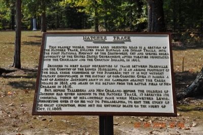
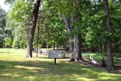
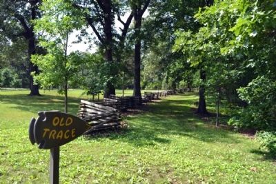
This plainly visible, though long deserted road is a section of The Natchez Trace, evolved from Buffalo and Indian Trails, into The First National Highway of the South-West, cut and opened under authority of the United States Government, after treaties negotiated with the Chickasaw and the Choctaw Indians, in 1801.
Designed to meet early necessities of trade between Nashville and the Country of the Lower Mississippi: It is an abiding footprint of the bold, crude commerce of the pioneers: Yet it is not without military significance in the history of our country. Over it passed a part of Andrew Jackson's army in his campaign against the Creek Indians in 1813, and again on his return from the Battle Field of New Orleans in 1815.
But, before Talledega and New Orleans- Before the soldiers of Jackson had given renown to the Natchez Trace, it received its immortal touch of melancholy fame when Meriwether Lewis, journeying over it on his way to Philadelphia, to edit the story of his Great Expedition, here met his untimely death on the night of Oct. 11, 1809.
Topics and series. This historical marker is listed in these topic lists: Native Americans • Roads & Vehicles. In addition, it is included in the Former U.S. Presidents: #07 Andrew Jackson , the Lewis & Clark Expedition, and the Natchez Trace series lists. A significant historical year for this entry is 1801.
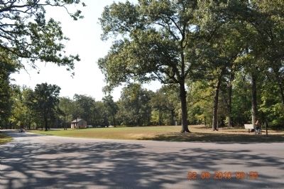
Location. 35° 30.608′ N, 87° 27.602′ W. Marker is near Hohenwald, Tennessee, in Lewis County. Marker can be reached from Natchez Trace Parkway (at milepost 385.9), 0.2 miles north of Summertown Highway (Tennessee Route 20). The marker is located between the Meriwether Lewis Memorial and the Grinder House at the Meriwether Lewis Site on the Natchez Trace. Touch for map. Marker is in this post office area: Hohenwald TN 38462, United States of America. Touch for directions.
Other nearby markers. At least 8 other markers are within 6 miles of this marker, measured as the crow flies. Grinder House (about 300 feet away, measured in a direct line); Meriwether Lewis (about 500 feet away); The Natchez Trace – Early American Trail (about 500 feet away); Meriwether Lewis: Life Compass (approx. 0.2 miles away); Metal Ford (approx. 3.4 miles away); Steele's Iron Works (approx. 3.4 miles away); Phosphate Mine (approx. 4.4 miles away); a different marker also named Meriwether Lewis (approx. 5.7 miles away). Touch for a list and map of all markers in Hohenwald.
Also see . . . Natchez Trace - Wikipedia. (Submitted on September 28, 2010, by Bill Pfingsten of Bel Air, Maryland.)
Photographed By Sandra Hughes, September 22, 2010
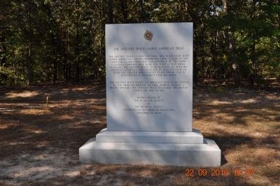
3. The Natchez Trace- Early American Trail
The Natchez Trace, a very old trail, was traveled by many early Americans.
Captain Meriwether Lewis of the The Lewis and Clark Expedition and Governor of the Upper Louisiana Territory, died near this point in 1809 while traveling The Natchez Trace to Washington D.C. with his Expedition Journals and accounts in 1843 the state of Tennessee created Lewis County in his honor, and in 1848 erected a monument over his grave.
The Natchez Trace played an important role in its service to the American Military General Andrew Jackson's Troops traveled The Natchez Trace to engage the British during the War of 1812.
Marker placed by the Tennessee Society
of
The National Society
Daughters of the American Revolution
November 10, 2006
Credits. This page was last revised on January 30, 2024. It was originally submitted on September 22, 2010, by Sandra Hughes Tidwell of Killen, Alabama, USA. This page has been viewed 1,104 times since then and 21 times this year. Last updated on May 28, 2011. Photos: 1, 2, 3, 4, 5. submitted on September 22, 2010, by Sandra Hughes Tidwell of Killen, Alabama, USA. 6, 7. submitted on June 23, 2015, by Duane Hall of Abilene, Texas. • Kevin W. was the editor who published this page.
