Near Montvale in Bedford County, Virginia — The American South (Mid-Atlantic)
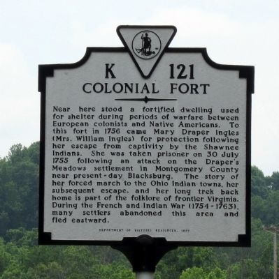
Colonial Fort
Erected 1997 by Department of Historic Resources. (Marker Number K-121.)
Topics and series. This historical marker is listed in these topic lists: Colonial Era • Forts and Castles • War, French and Indian. In addition, it is included in the Virginia Department of Historic Resources (DHR) series list. A significant historical date for this entry is July 30, 1755.
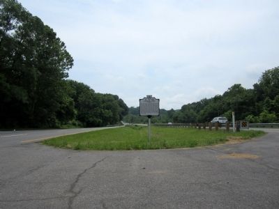
Location. 37° 22.292′ N, 79° 41.975′ W. Marker is near Montvale, Virginia, in Bedford County. Marker is on West Lynchburg Salem Turnpike (U.S. 460) 0.3 miles west of Circle K Road (Virginia Route 751), in the median. Touch for map . Marker is in this post office area: Montvale VA 24122, United States of America. Touch for directions.
Other nearby markers. At least 8 other markers are within 8 miles of this marker, measured as the crow flies. Botetourt County / Bedford County (approx. 3.7 miles away); 1889 Thaxton Train Wreck (approx. 4.2 miles away); Appalachian Trail (approx. 5.2 miles away); Peaks of Otter (approx. 7.1 miles away); A Community at "the Mons" (approx. 7.1 miles away); a different marker also named Peaks of Otter (approx. 7.1 miles away); Hunter's Bivouac (approx. 7.3 miles away); Abbott Lake (approx. 7.4 miles away).
Related markers. Click here for a list of markers that are related to this marker. This sequence of markers show Mary Ingle’s journey from her capture to her return.
Credits. This page was last revised on July 3, 2021. It was originally submitted on May 30, 2011, by Bernard Fisher of Richmond, Virginia. This page has been viewed 1,423 times since then and 99 times this year. Photos: 1, 2. submitted on May 30, 2011, by Bernard Fisher of Richmond, Virginia.

