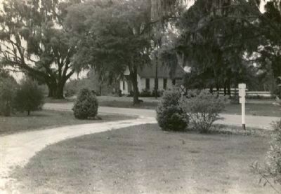
Coosawhatchie in Jasper County, South Carolina — The American South (South Atlantic)
Coosawhatchie
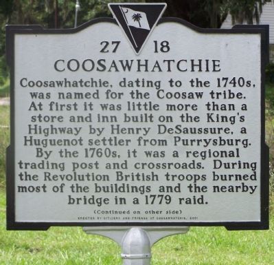
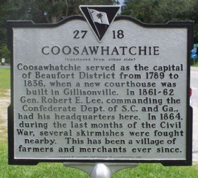
Coosawatchie served as the capital of Beaufort District from 1789 to 1836, when a new courthouse was built in Gillisonville. In 1861-62 Gen. Robert E. Lee, commanding the Confederate Dept. of S.C. and Ga., had his headquarters here. In 1864, during the last months of the Civil War, several skirmishes were fought nearby. This has been a village of farmers and merchants ever since.
Erected 2001 by Citizens and Friends of Coosawhatchie. (Marker Number 27 18.)
Topics. This historical marker is listed in these topic lists: Colonial Era • Settlements & Settlers • War, US Civil • War, US Revolutionary. A significant historical year for this entry is 1779.
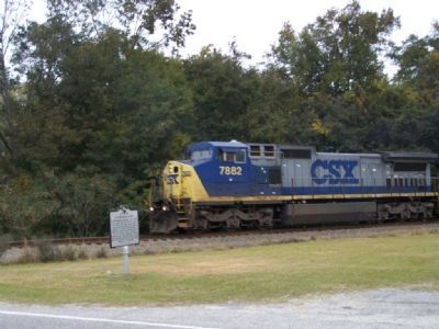
Location. 32° 35.325′ N, 80° 55.775′ W. Marker is in Coosawhatchie, South Carolina, in Jasper County. Marker is on State Highway 462. 1/4 mile off US 17 N, I-95 Interchange 28. Touch for map . Marker is in this post office area: Coosawhatchie SC 29912, United States of America. Touch for directions.
Other nearby markers. At least 8 other markers are within 5 miles of this marker, measured as the crow flies. Battle of Coosawhatchie (approx. 0.2 miles away); Battle at the Tulifinny Crossroads (approx. 1.4 miles away); General Robert E. Lee (approx. 4.2 miles away); Gillisonville Baptist Church (approx. 4.2 miles away); The Battle of Pocotaligo (approx. 4.3 miles away); Gillisonville (approx. 4.3 miles away); " The Frampton Line " (approx. 4˝ miles away); Southern Live Oak Tree (approx. 4˝ miles away).
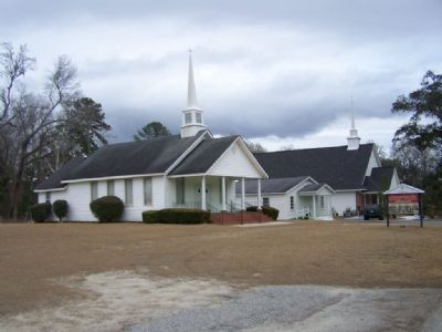
Regarding Coosawhatchie. Local landmarks include Coosawhatchie Church, Coosawhatchie School , Little Bees Creek, and Saint Paul's Church.
Coosawhatchie is a settlement is 487 miles from the US capital Washington, DC.
Also see . . . Expedition to Coosawhatchie. Account of one of the Civil War incidents that occurred nearby. (Submitted on December 18, 2007, by Craig Swain of Leesburg, Virginia.)
Additional commentary.
1. Gillisonville
Nearby Gillisonville, mentioned on the marker, was among many communities to suffer with the passing of General Sherman's Army during the Carolinas Campaign. Every building except the Baptist Church and a single residential home were destroyed in 1865.
— Submitted December 18, 2007, by Craig Swain of Leesburg, Virginia.
Credits. This page was last revised on August 31, 2022. It was originally submitted on December 18, 2007, by Mike Stroud of Bluffton, South Carolina. This page has been viewed 5,184 times since then and 209 times this year. Photos: 1, 2, 3. submitted on December 18, 2007, by Mike Stroud of Bluffton, South Carolina. 4. submitted on January 9, 2008, by Mike Stroud of Bluffton, South Carolina. 5. submitted on November 27, 2009, by Linda Hutton of Germantown, Maryland. • Craig Swain was the editor who published this page.
Editor’s want-list for this marker. Photos of Coosawhatchie School , Little Bees Creek, and Saint Paul's Church. • Can you help?
