Locust Grove in Orange County, Virginia — The American South (Mid-Atlantic)
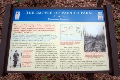
The Battle of Payne’s Farm
Unexpected Encounter
“The Union soldiers came in sight of a road, along which the rebel baggage wagons and ambulances were being driven at a rapid rate, when they met with a firm resistance from the enemy in front.” — Regimental History, 1st Massachusetts Infantry, USA
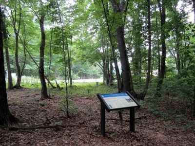
The Battle of Payne’s Farm began at the intersection beyond the trees in front of you on the afternoon of November 27, 1863, as men of the Union III Corps met portions of Confederate Gen. Edward Johnson’s division. Even though pickets on both sides had encountered each other throughout the morning, neither side recognized the other as anything more than a small scouting party. That afternoon, as Johnson’s column was passing the intersection, however, Federal skirmishers in these woods fired upon the surprised Confederates on the Raccoon Ford Road to your left.
Gen. George H. Steuart, bringing up the Confederate rear, halted his brigade and quickly formed a line of battle in the road. On arriving and surveying the scene, Johnson ordered the rest of his division to countermarch to the scene of the action. It is unclear whether Johnson knew the full strength of the force he was facing, but it seemed to make no difference to him. In the woods and fields adjoining this intersection, one Confederate division confronted a Union army corps three times its size.
(captions)
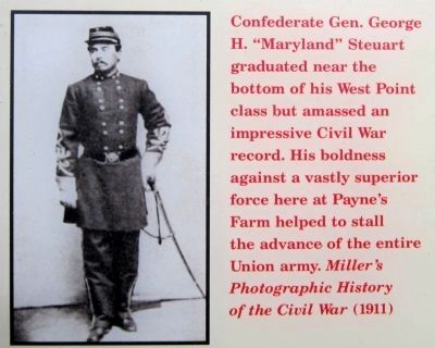
Confederate Gen. George H. “Maryland” Steuart graduated near the bottom of his West Point class but amassed an impressive Civil War record. His boldness against a vastly superior force here at Payne’s Farm helped to stall the advance of the entire Union army. Miller’s Photographic History of the Civil War(1911)
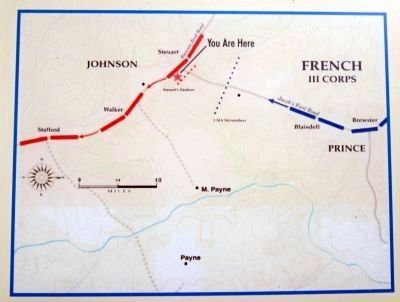
The Battle of Payne’s Farm began at the intersection in front of you when the advance of the Union III Corps fired upon the ambulances of Confederate Gen. Edward Johnson’s division.
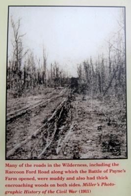
Many of the roads in the Wilderness, including the Raccoon Ford Road along which the Battle of Payne’s Farm opened, were muddy and also had thick encroaching woods on both sides. Miller’s Photographic History of the Civil War (1911)
Erected 2011 by The Civil War Trust and Virginia Civil War Trails.
Topics and series. This historical marker is listed in this topic list: War, US Civil. In addition, it is included in the Virginia Civil War Trails series list. A significant historical date for this entry is November 27, 1863.
Location. 38° 20.091′ N, 77° 49.822′ W. Marker is in Locust Grove, Virginia, in Orange County. Marker can be reached from Zoar Road (Virginia Route 611) near Indiantown Road (Virginia Route 603). Touch for map. Marker is at or near this postal address: 31334 Zoar Road, Locust Grove VA 22508, United States of America. Touch for directions.
Other nearby markers. At least 8 other markers are within walking distance of this marker. A different marker also named The Battle of Payne’s Farm (approx. 0.2 miles away); The Mine Run Campaign (approx. 0.2 miles away); a different marker also named The Mine Run Campaign (approx. 0.2 miles away); a different marker also named The Battle of Payne’s Farm (approx. 0.2 miles away); a different marker also named The Battle of Payne’s Farm (approx. Ľ mile away); a different marker also named The Battle of Payne’s Farm (approx. 0.3 miles away); a different marker also named The Battle of Payne’s Farm (approx. 0.3 miles away); a different marker also named The Battle of Payne’s Farm (approx. 0.3 miles away). Touch for a list and map of all markers in Locust Grove.
Also see . . .
1. Mine Run (Payne's Farm). American Battlefield Trust (Submitted on June 6, 2011.)
2. The Mine Run Campaign by James K. Bryant II. Essential Civil War Curriculum, Virginia Center for Civil War Studies at Virginia Tech (Submitted on June 6, 2011.)
Credits. This page was last revised on February 23, 2022. It was originally submitted on June 6, 2011, by Bernard Fisher of Richmond, Virginia. This page has been viewed 1,749 times since then and 45 times this year. Last updated on April 16, 2018, by Bradley Owen of Morgantown, West Virginia. Photos: 1, 2, 3, 4, 5. submitted on June 6, 2011, by Bernard Fisher of Richmond, Virginia.
