Near Milledgeville in Baldwin County, Georgia — The American South (South Atlantic)
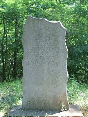
Old Fort Wilkinson
Where treaty of limits took place between the United States and Creek Nation of Indians
June 16, 1802, ratified Jan. 11, 1803
This treaty was signed by James Wilkinson, Benjamin Hawkins, Andrew Pickens, Commissioners on the part of the United States and forty chiefs and warriors.
Erected 1971 by Nancy Hart Chapter Daughters of the American Revolution.
Topics and series. This historical marker is listed in these topic lists: Forts and Castles • Native Americans • Settlements & Settlers • Wars, US Indian. In addition, it is included in the Daughters of the American Revolution series list. A significant historical date for this entry is June 16, 1802.
Location. 33° 2.735′ N, 83° 12.599′ W. Marker is near Milledgeville, Georgia, in Baldwin County. Marker can be reached from Rock Hill Road east of Vinson Highway (County Route 112) when traveling south. Touch for map. Marker is in this post office area: Milledgeville GA 31061, United States of America. Touch for directions.
Other nearby markers. At least 8 other markers are within 2 miles of this marker, measured as the crow flies. Fort Wilkinson (about 700 feet away, measured in a direct line); Cedar Lane Cemetery (approx. 0.7 miles away); The Walker Building (approx. 0.8 miles away); Powell Building (approx. 0.8 miles away); Milledgeville State Hospital (approx. 0.8 miles away); The Green Building (approx. 0.8 miles away); Cornerstone/Auditorium Building (approx. 0.9 miles away); Summer Home (of) Governor Herschel V. Johnson (approx. 1˝ miles away). Touch for a list and map of all markers in Milledgeville.
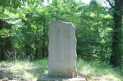
More about this marker. The marker is located .2 mile from the Fort Wilkinson marker on Vinson Road. It is located at the site of the old fort about 100 yards up the hill from the parking area.
Also see . . . U.S. - Creek Treaty of Fort Wilkinson. Text of the actual treaty of 1802 is detailed. (Submitted on June 20, 2011.)
Credits. This page was last revised on January 10, 2024. It was originally submitted on June 6, 2011, by Charles Smith of Milledgeville, Baldwin Georgia. This page has been viewed 1,687 times since then and 65 times this year. Last updated on January 10, 2024, by Carl Gordon Moore Jr. of North East, Maryland. Photos: 1, 2. submitted on June 6, 2011, by Charles Smith of Milledgeville, Baldwin Georgia. • J. Makali Bruton was the editor who published this page.

