La Porte in LaPorte County, Indiana — The American Midwest (Great Lakes)
Indiana Territory Boundary Line
Inscription.
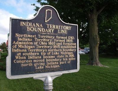
Side One
Northwest Territory formed 1787; Indiana Territory formed 1800. Admission of Ohio 1803 and formation of Michigan Territory 1805 established Indiana Territory's northern boundary at southern tip of Lake Michigan. When Indiana became state in 1816, Congress moved boundary ten miles north giving Indiana part of Lake Michigan.
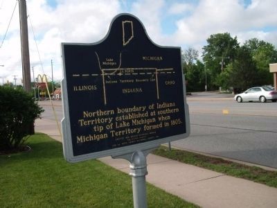
Side Two
[Map of territorial boundary line at top of marker with following text under it]:
Northern boundary of Indiana Territory established at southern tip of Lake Michigan when Michigan Territory formed in 1805.
Erected 1999 by Indiana Historical Bureau, The Hinton Family, and LaPorte County Historical Society, Inc. (Marker Number 46.1999.1.)
Topics and series. This historical marker is listed in this topic list: Landmarks. In addition, it is included in the Indiana Historical Bureau Markers series list. A significant historical year for this entry is 1787.
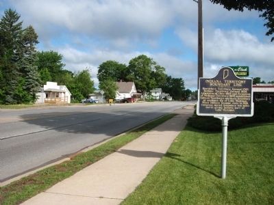
Location. 41° 36.997′ N, 86° 43.96′ W. Marker is in La Porte, Indiana, in LaPorte County. Marker is on Pine Lake Avenue north of Weller / Truesdell Ave., on the right when traveling north. Located in front of "KFC" with the use of their parking lot. Touch for map. Marker is at or near this postal address: 213 Pine lake Avenue, La Porte IN 46350, United States of America. Touch for directions.
Other nearby markers. At least 8 other markers are within walking distance of this marker. Memorial Forest Planting (approx. ¼ mile away); La Porte World War II Memorial (1991) (approx. ¼ mile away); La Porte Korean War Memorial (approx. ¼ mile away); La Porte World War II Memorial (approx. ¼ mile away); Operation Desert Storm Memorial (approx. ¼ mile away); La Porte Viet Nam Memorial (approx. ¼ mile away); La Porte County Afghanistan–Iraq–Kuwait Memorial (approx. ¼ mile away); Indian Boundary Line (approx. 0.4 miles away). Touch for a list and map of all markers in La Porte.
Related markers. Click here for a list of markers that are related to this marker. To better understand the relationship, study each marker in the order shown.
Credits. This page was last revised on November 23, 2020. It was originally submitted on June 13, 2011, by Al Wolf of Veedersburg, Indiana. This page has been viewed 830 times since then and 18 times this year. Photos: 1, 2, 3, 4. submitted on June 13, 2011, by Al Wolf of Veedersburg, Indiana. • Bill Pfingsten was the editor who published this page.


