Akron in Summit County, Ohio — The American Midwest (Great Lakes)
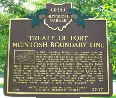
Treaty of Fort McIntosh Boundary Line
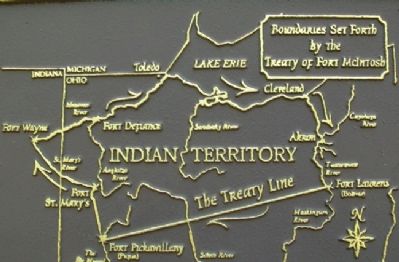
In 1785, American Indian tribal leaders from the Chippewa, Delaware, Ottawa, and Wyandot met with representatives sent by the United States Congress to sign the controversial Treaty of Fort McIntosh. The treaty surrendered control of Native American lands in southern and eastern Ohio to the United States government. Most Indians rejected the validity of the treaty and rather than improving relations, the Treaty of Fort McIntosh only intensified the tensions that existed between the United States government and the Indian tribes. This marker signifies the eastern most portion of the American Indian territory outlined by the treaty. The Portage Path, a trail used by American Indians as a portage between the Cuyahoga and Tuscarawas rivers, became a part of this boundary line.
Erected 2005 by Metro Parks, Serving Summit County and The Ohio Historical Society. (Marker Number 37-77.)
Topics and series. This historical marker is listed in these topic lists: Native Americans • Peace. In addition, it is included in the Ohio Historical Society / The Ohio History Connection series list. A significant historical year for this entry is 1785.
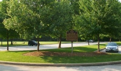
Location. 41° 7.622′ N, 81° 32.773′ W. Marker is in Akron, Ohio, in Summit County. Marker is at the Sand Run Metro Parks' Parcours Trail Soccer Field parking lot. Touch for map. Marker is at or near this postal address: 995 Treaty Line Road, Akron OH 44313, United States of America. Touch for directions.
Other nearby markers. At least 8 other markers are within 2 miles of this marker, measured as the crow flies. 1797 Portage Path Survey (approx. 0.4 miles away); The Portage Path Connected Lake Erie with the Ohio River (approx. 0.4 miles away); Yeck Family Portage Path North Terminus Memorial (approx. 0.4 miles away); Portage Path North Terminus (approx. 0.4 miles away); The Old Portage Path (approx. 0.4 miles away); The Gate Lodge, Stan Hywet Hall & Gardens (approx. ¾ mile away); Astronaut Judith Resnik (approx. 1.2 miles away); Chestnut Hill Veterans Memorial Garden (approx. 1.4 miles away). Touch for a list and map of all markers in Akron.
Also see . . .
1. Sand Run Metro Park History. (Submitted on June 19, 2011, by William Fischer, Jr. of Scranton, Pennsylvania.)
2. Treaty of Fort McIntosh. (Submitted on June 19, 2011, by William Fischer, Jr. of Scranton, Pennsylvania.)
Credits. This page was last revised on June 16, 2016. It was originally submitted on June 18, 2011, by William Fischer, Jr. of Scranton, Pennsylvania. This page has been viewed 2,179 times since then and 97 times this year. Photos: 1, 2, 3. submitted on June 19, 2011, by William Fischer, Jr. of Scranton, Pennsylvania.


