Near Trout Run in Lycoming County, Pennsylvania — The American Northeast (Mid-Atlantic)
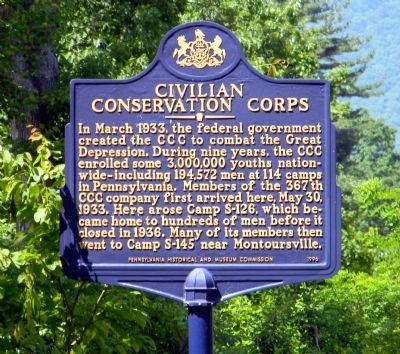
Civilian Conservation Corps
Erected 1996 by Pennsylvania Historical and Museum Commission.
Topics and series. This historical marker is listed in these topic lists: Charity & Public Work • Man-Made Features. In addition, it is included in the Civilian Conservation Corps (CCC), and the Pennsylvania Historical and Museum Commission series lists. A significant historical month for this entry is March 1933.
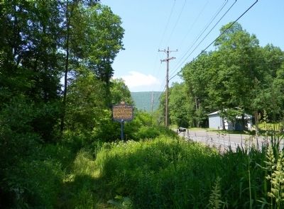
Location. 41° 25.443′ N, 77° 1.071′ W. Marker is near Trout Run, Pennsylvania, in Lycoming County. Marker is on Pennsylvania Route 14, 0.4 miles north of Lower Grays Run Road, on the right when traveling north. Touch for map. Marker is in this post office area: Trout Run PA 17771, United States of America. Touch for directions.
Other nearby markers. At least 8 other markers are within 11 miles of this marker, measured as the crow flies. Sheshequin Path (approx. 2.1 miles away); a different marker also named Sheshequin Path (approx. 3.7 miles away); Ralston Railroad Bridge (approx. 6˝ miles away); Blooming Grove Dunkard Meeting House (approx. 7 miles away); Williamson Road (approx. 9.6 miles away); Site of the Block House (approx. 10.3 miles away); Veterans Memorial (approx. 10.3 miles away); Staff Sergeant Ryan Scott Ostrom (approx. 10.3 miles away). Touch for a list and map of all markers in Trout Run.
Related marker. Click here for another marker that is related to this marker. To better understand the relationship, study the marker shown.
Also see . . .
1. Pennsylvania Civilian Conservation Camps. A resource for Pennsylvania CCC Information (Submitted on June 19, 2011, by PaulwC3 of Northern, Virginia.)
2. Civilian Conservation Corps - Behind the Marker. ExplorePAHistory.com (Submitted on July 20, 2011, by Mike Wintermantel of Pittsburgh, Pennsylvania.)
Credits. This page was last revised on June 16, 2016. It was originally submitted on June 19, 2011, by PaulwC3 of Northern, Virginia. This page has been viewed 808 times since then and 50 times this year. Photos: 1, 2. submitted on June 19, 2011, by PaulwC3 of Northern, Virginia.

