Near North Columbia in Nevada County, California — The American West (Pacific Coastal)
North Bloomfield Drain Tunnel
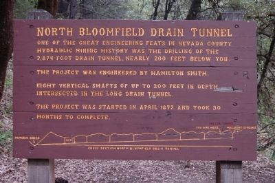
One of the great engineering feats in Nevada County hydraulic mining history was the drilling of the 7,874 foot drain tunnel, nearly 200 feet below you.
This project was engineered by Hamilton Smith.
Eight vertical shafts of up to 200 feet in depth intersected in the long drain tunnel.
The project was started in April 1872 and took 30 months to complete.
Topics. This historical marker is listed in this topic list: Industry & Commerce. A significant historical month for this entry is April 1872.
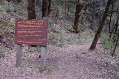
Location. 39° 22.003′ N, 120° 55.305′ W. Marker is near North Columbia, California, in Nevada County. Marker is on North Bloomfield Road. This marker is located in Malakoff Diggings State Historic Park on North Bloomfield Road about 1 mile Southwest of North Bloomfield. Touch for map. Marker is in this post office area: Nevada City CA 95959, United States of America. Touch for directions.
Other nearby markers. At least 8 other markers are within 2 miles of this marker, measured as the crow flies. North Bloomfield Mining and Gravel Company (approx. half a mile away); North Bloomfield School (approx. 0.9 miles away); St. Columncille's Church (approx. 0.9 miles away); Alvin Stevens Trivelpiece (approx. 1.1 miles away); Shoot (Chute) Hill (approx. 1.1 miles away); Malakoff Diggins Clampicnic Area (approx. 1.1 miles away); Giant (approx. 1.2 miles away); Site of Lake City (approx. 1.3 miles away). Touch for a list and map of all markers in North Columbia.
Regarding North Bloomfield Drain Tunnel. The Malakoff Diggins State Historic Park website tells of the two tunnels here near this marker site:
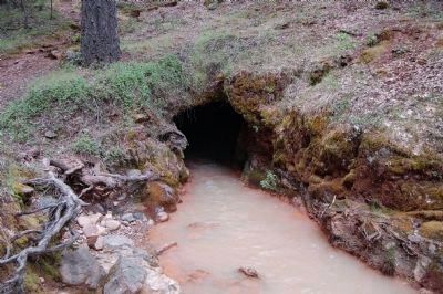
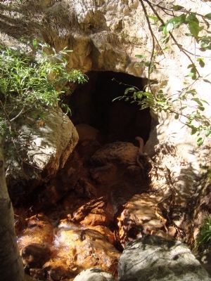
The Hiller Tunnel: The tunnel was built between 1851 and 1856. It was financed by Dr. Hillerscheidt and D. Albert. This original mining debris drainage tunnel was later purchased by North Bloomfield Gravel Mining Company and can still be seen today. If you plan to walk through this 557’ tunnel during the dry summer months, bring a flashlight and water shoes.
The North Bloomfield Tunnel: To handle the needs of more gravel tailings and water volume the miners decided to build a bigger tunnel. In 1872 W. Hamilton Smith designed and began construction on the 7,878 foot North Bloomfield Tunnel.
This drainage tunnel, built 200’ below the Hiller Tunnel, was constructed to drain away the huge volume of rocks, gravel and mud washing out of the mining pit. It took the miners only a year and half to complete the tunnel. It was considered an engineering marvel, utilizing
two crews in each shaft. Once miners reaching the bottom of the shaft the men would separate and work in opposite directions to connect with the crews working from the next shaft. There are 8 shafts leading to the bedrock below.
The tunnel has long since filled in with water and debris. It is no longer navigable, but you will see the tops of some of the air shafts as you walk down Humbug Trail.
Also see . . . North Bloomfield Mining and Gravel Company - Wikipedia. (Submitted on June 22, 2011, by Barry Swackhamer of Brentwood, California.)
Additional commentary.
1. Marker History
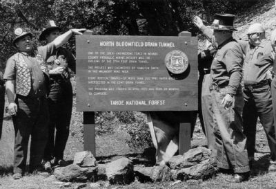
The wooden marker seen in Photo #3 was originally placed by the National Forest Service near the Tunnel. The marker was replaced by a bronze plaque on October 3, 1981 but was erroneously titled "Hiller Tunnel". It was later stolen by vandals. The current marker seen in Photo #1 was then placed at the trail leading to the site of the tunnel.
— Submitted June 24, 2011.
Additional keywords. California Gold Rush, Hydraulic Mining
Credits. This page was last revised on August 17, 2020. It was originally submitted on June 22, 2011, by Barry Swackhamer of Brentwood, California. This page has been viewed 1,431 times since then and 38 times this year. Photos: 1, 2. submitted on June 22, 2011, by Barry Swackhamer of Brentwood, California. 3. submitted on June 24, 2011, by Syd Whittle of Mesa, Arizona. 4. submitted on June 22, 2011, by Barry Swackhamer of Brentwood, California. 5. submitted on July 28, 2011, by Barry Swackhamer of Brentwood, California. • Syd Whittle was the editor who published this page.
