Central Minneapolis in Hennepin County, Minnesota — The American Midwest (Upper Plains)
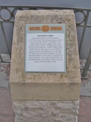
William de la Barre
Saint Anthony Falls Heritage Trail
After the Washburn A Mill explosion in 1878, a young Vienna-born engineer called on owner Cadwallader C. Washburn with a dust-collecting device that he said would prevent such accidents. Washburn hired him to oversee rebuilding the A Mill. William de la Barre stayed as the engineer for the milling companies that controlled the use of the falls. By improving the water distribution system, he increased the over-all output of waterpower nearly six times. His work ushered in the era of hydroelectricity at the falls, and he remained active until his death in 1936.
Erected by the St. Anthony Falls Heritage Board.
Topics. This historical marker is listed in these topic lists: Industry & Commerce • Waterways & Vessels. A significant historical year for this entry is 1878.
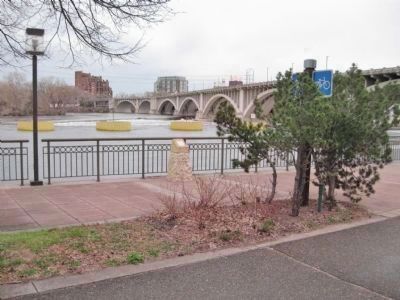
Location. 44° 58.985′ N, 93° 15.745′ W. Marker is in Minneapolis, Minnesota, in Hennepin County. It is in Central Minneapolis. Marker is on West River Parkway, ¼ mile west of Portland Avenue South, on the right when traveling west. Marker is along a walking path next to the Mississippi River. Touch for map. Marker is in this post office area: Minneapolis MN 55401, United States of America. Touch for directions.
Other nearby markers. At least 8 other markers are within walking distance of this marker. Indians at the Falls (within shouting distance of this marker); The Barrel-Makers' Co-ops (about 500 feet away, measured in a direct line); The House of John H. Stevens (about 600 feet away); Stevens House (about 600 feet away); The Washburn and Pillsbury Clans (about 600 feet away); Bridging the Stream (about 700 feet away); Bridge Square to the Gateway (approx. 0.2 miles away); Joseph N. Nicollet (approx. 0.2 miles away). Touch for a list and map of all markers in Minneapolis.
Also see . . . William de la Barre. Wikipedia entry. (Submitted on June 22, 2011.)
Credits. This page was last revised on February 12, 2023. It was originally submitted on June 22, 2011, by Keith L of Wisconsin Rapids, Wisconsin. This page has been viewed 717 times since then and 19 times this year. Photos: 1, 2. submitted on June 22, 2011, by Keith L of Wisconsin Rapids, Wisconsin.

