Near North Columbia in Nevada County, California — The American West (Pacific Coastal)
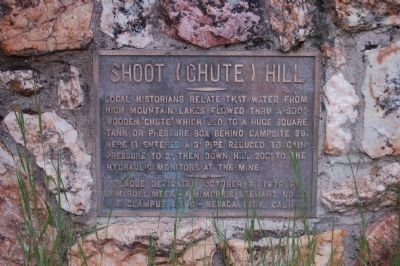
Shoot (Chute) Hill
Erected 1971 by E Clampus Vitus, Wm. Bull Meek – Wm. Morris Stewart, No. 10 (re-dedicated 1979).
Topics and series. This historical marker is listed in this topic list: Industry & Commerce. In addition, it is included in the E Clampus Vitus series list.
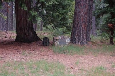
Location. 39° 22.51′ N, 120° 54.227′ W. Marker is near North Columbia, California, in Nevada County. Marker can be reached from North Bloomfield Road. The marker is located opposite Camp Site #28 at the Malakoff Diggins State Historic Park's Chute Hill Campground. Touch for map. Marker is at or near this postal address: 24126 North Bloomfield Road, Nevada City CA 95959, United States of America. Touch for directions.
Other nearby markers. At least 8 other markers are within 3 miles of this marker, measured as the crow flies. Alvin Stevens Trivelpiece (about 400 feet away, measured in a direct line); North Bloomfield School (approx. half a mile away); Giant (approx. half a mile away); Malakoff Diggins Clampicnic Area (approx. half a mile away); St. Columncille's Church (approx. 0.6 miles away); North Bloomfield Mining and Gravel Company (approx. 0.7 miles away); North Bloomfield Drain Tunnel (approx. 1.1 miles away); Site of Lake City (approx. 2½ miles away). Touch for a list and map of all markers in North Columbia.
More about this marker. Malakoff Diggins State Historic Park is located approximately 22 miles north of Nevada City off of State Highway 49.
Also see . . .
1. Hydraulic Mining - Wikipedia. (Submitted on June 22, 2011, by Barry Swackhamer of Brentwood, California.)
2. Gold Fever, Giant Gold Machines - Hydraulic Mining. (Submitted on June 22, 2011, by Barry Swackhamer of Brentwood, California.)
Additional keywords. Malakoff Diggings State Historical Park, Hydraulic Mining
Credits. This page was last revised on June 16, 2016. It was originally submitted on June 22, 2011, by Barry Swackhamer of Brentwood, California. This page has been viewed 464 times since then and 14 times this year. Photos: 1, 2. submitted on June 22, 2011, by Barry Swackhamer of Brentwood, California. • Syd Whittle was the editor who published this page.

