Allouez in Brown County, Wisconsin — The American Midwest (Great Lakes)
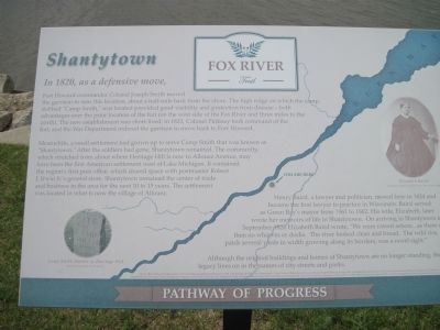
Shantytown
In 1820, as a defensive move,
— Fox River Trail —
Fort Howard commander Colonel Joseph Smith moved the garrison to near this location, about a half-mile back from the shore. The high ridge on which the camp, dubbed “Camp Smith,” was located provided good visibility and protection from disease - both advantages over the prior location of the fort (on the west side of the Fox River and three miles to the north). The new establishment was short-lived: in 1822, Colonel Pinkney took command of the fort, and the War Department ordered the garrison to move back to Fort Howard.
Meanwhile, a small settlement had grown up to serve Camp Smith that was known as “Shantytown.” After the soldiers had gone, Shantytown remained. The community, which stretched from about where Heritage Hill is now to Allouez Avenue, may have been the first American settlement west of Lake Michigan. It contained the region's first post office, which shared space with postmaster Robert J. Irwin Jr.'s general store. Shantytown remained the center of trade and business in the area for for the next 10 to 15 years. The settlement was located in what is now the village of Allouez.
Henry Baird, a lawyer and politician, moved here in 1824 and became the first lawyer to practice in Wisconsin. Baird served as Green Bay's mayor from 1861 to 1862. His wife, Elizabeth, later wrote her memoirs of life in Shantytown. On arriving in Shantytown in September 1824 Elizabeth Baird wrote, “We were rowed ashore...as there were then no wharves or docks. The river looked clean and broad. The wild rice, a patch several yards in width growing along the borders, was a novel sight.”
Although the original buildings and homes of Shantytown are no longer standing, the legacy lives on in the names of city streets and parks.
Topics. This historical marker is listed in these topic lists: Forts and Castles • Settlements & Settlers. A significant historical month for this entry is September 1824.
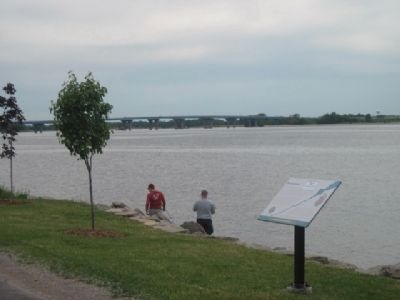
Location. 44° 29.06′ N, 88° 1.872′ W. Marker is in Allouez, Wisconsin, in Brown County. Marker can be reached from Riverside Drive (State Highway 57) north of Allouez Avenue. Located on the Fox River Trail. Touch for map. Marker is in this post office area: Green Bay WI 54301, United States of America. Touch for directions.
Other nearby markers. At least 8 other markers are within 2 miles of this marker, measured as the crow flies. Curly Lambeau's Gravesite (a few steps from this marker); First Redemptorist Church in America (about 400 feet away, measured in a direct line); First Episcopal Mission in Wisconsin (approx. 0.4 miles away); The Port & the Environment (approx. 0.6 miles away); Menomineeville, Seat of Justice (approx. 0.7 miles away); The Catholic Bark Chapel
(approx. ¾ mile away); Site of Camp Smith 1820 (approx. ¾ mile away); Hazelwood (approx. 1.3 miles away). Touch for a list and map of all markers in Allouez.
More about this marker. On the lower left is a 2008 photo by Jim Dockendorff "Camp Smith Marker at Heritage Hill" and on the right a photo of "Elizabeth Baird" courtesy of Heritage Hill State Historical Park
Related markers. Click here for a list of markers that are related to this marker.
Also see . . . Fox River Trail. (Submitted on June 27, 2011, by Bernard Fisher of Richmond, Virginia.)
Credits. This page was last revised on July 23, 2018. It was originally submitted on June 23, 2011, by Bob (peach) Weber of Dewey, Arizona. This page has been viewed 1,539 times since then and 62 times this year. Last updated on June 27, 2011, by Bob (peach) Weber of Dewey, Arizona. Photos: 1, 2, 3. submitted on June 23, 2011, by Bob (peach) Weber of Dewey, Arizona. • Bernard Fisher was the editor who published this page.


