Pennsville in Salem County, New Jersey — The American Northeast (Mid-Atlantic)
Pea Patch Island Heronry
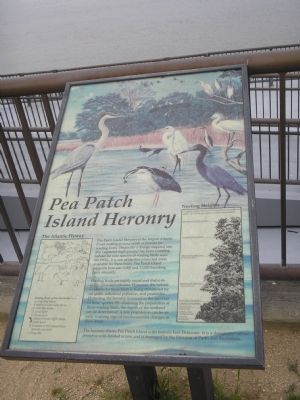
Wading birds are highly social and thrive in noisy crowded colonies. However, the habitat available for these birds is being threatened by oil spills, industrial pollution, and pesticides. Protecting the heronry is critical to the survival of these species. By observing the population of these wading birds, the health of the wetland can be determined. A low population can be an early warning sign of environmental changes in these areas.
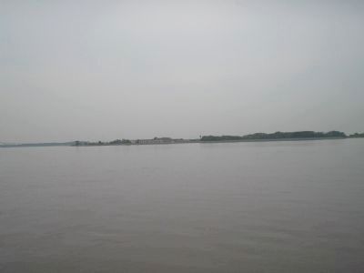
The heronry shares Pea Patch Island with historic Fort Delaware. It is a designated nature preserve with limited access and is managed by the Division of Parks and Recreation.
Topics. This historical marker is listed in these topic lists: Animals • Science & Medicine.
Location. 39° 36.129′ N, 75° 33.197′ W. Marker is in Pennsville, New Jersey, in Salem County. Marker can be reached from Fort Mott Road, on the right when traveling south. Marker is in Fort Mott State Park, at the ferry dock. Touch for map. Marker is in this post office area: Pennsville NJ 08070, United States of America. Touch for directions.
Other nearby markers. At least 8 other markers are within walking distance of this marker. Pea Patch Island (about 600 feet away, measured in a direct line); Two Batteries in one (about 600 feet away); The Wharf (about 600 feet away); Battery Arnold (about 700 feet away); Generator Room (about 700 feet away); Switchboard Room / Plotting Room (about 700 feet away); The Latrines (about 800 feet away); Battery Harker (about 800 feet away). Touch for a list and map of all markers in Pennsville.
More about this marker. The top of the marker features a picture of some of the birds found in the Pea Patch Island Heronry. A sidebar identifies each bird:
Wading Birds of Pea Patch Heronry
A. Great Blue Heron
B. Black-Crowned Night Heron
C. Little Blue Heron
D. Great Egret
E. Snowy Egret
F. Yellow-Crowned Night Heron
G. Cattle Egret
H. Louisiana or Tri-Colored Heron (juvenile and adult)
I. Glossy Ibis
The right side of the marker describes the habits of the birds found here:
Nesting Heights
The different species of birds in the heronry tend to nest at different heights. Here are the approximate nest heights for each species.
Great Blue Heron 50 feet (tall trees)
Great Egret
40 feet (tall trees)
Yellow-Crowned Night Heron 30 feet (small trees)
Black-Crowned Night Heron 15 feet (small trees)
Snowy Egret 5 feet (shrubs)
Cattle Egret 3 feet (shrubs)
Tri-Colored Heron 2 feet (shrubs)
Little Blue Heron 1½ feet (shrubs)
Glossy Ibis (low shrubs)
Credits. This page was last revised on November 29, 2023. It was originally submitted on July 1, 2011, by Bill Coughlin of Woodland Park, New Jersey. This page has been viewed 927 times since then and 40 times this year. Photos: 1, 2. submitted on July 1, 2011, by Bill Coughlin of Woodland Park, New Jersey.

