Annandale in Fairfax County, Virginia — The American South (Mid-Atlantic)
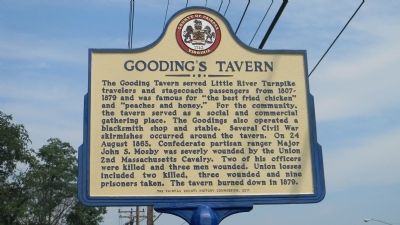
Gooding's Tavern
Erected 2011 by The Fairfax County History Commission.
Topics and series. This historical marker is listed in these topic lists: Industry & Commerce • Roads & Vehicles • War, US Civil. In addition, it is included in the Virginia, Fairfax County History Commission series list. A significant historical year for this entry is 1863.
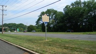
Location. 38° 50.205′ N, 77° 14.201′ W. Marker is in Annandale, Virginia, in Fairfax County. Marker is on Little River Turnpike (Virginia Route 236) east of Wakefield Chapel Road, on the right when traveling west. Marker is just outside the boundaries of the Pleasant Valley Memorial Park, across the LRT from the campus of the Northern Virginia Community College, and four blocks west of the Capitol Beltway (I-495). Touch for map. Marker is at or near this postal address: 8420 Little River Turnpike, Annandale VA 22003, United States of America. Touch for directions.
Other nearby markers. At least 8 other markers are within 3 miles of this marker, measured as the crow flies. The Guinea Road Cemetery Reinterment (about 600 feet away, measured in a direct line); Ilda (approx. 0.8 miles away); The Pines (approx. 1.3 miles away); Mosby Attacks Annandale (approx. 1.3 miles away); Burke’s Station Raid (approx. 1.8 miles away); Ravensworth (approx. 2.1 miles away); a different marker also named Ravensworth (approx. 2.1 miles away); Little River Turnpike (approx. 2.2 miles away). Touch for a list and map of all markers in Annandale.
Additional keywords. Ilda
Credits. This page was last revised on December 25, 2019. It was originally submitted on July 3, 2011, by Richard E. Miller of Oxon Hill, Maryland. This page has been viewed 3,459 times since then and 94 times this year. Photos: 1, 2. submitted on July 3, 2011, by Richard E. Miller of Oxon Hill, Maryland. • Craig Swain was the editor who published this page.

