Near Brandy Station in Culpeper County, Virginia — The American South (Mid-Atlantic)
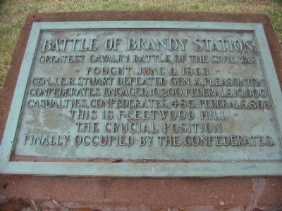
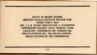
Battle of Brandy Station
• Fought June 9, 1863 •
Gen. J.E.B. Stuart defeated Gen. A. Pleasonton
Confederates engaged 10,200. Federals 10,900
Casualties, Confederates, 485, Federals 866
This is Fleetwood Hill
The crucial position
Finally occupied by the Confederates
Erected 1926 by United Daughers of the Confederacy.
Topics and series. This historical marker is listed in this topic list: War, US Civil. In addition, it is included in the Battlefield Markers Association series list. A significant historical date for this entry is June 9, 1711.
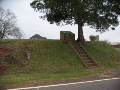
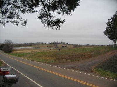
Location. 38° 30.569′ N, 77° 52.778′ W. Marker is near Brandy Station, Virginia, in Culpeper County. Marker is on Fleetwood Heights Road (County Route 685), on the right when traveling east. Located at the crest of Fleetwood Hill along the trace of the Old Carolina Road. Touch for map. Marker is in this post office area: Brandy Station VA 22714, United States of America. Touch for directions.
Other nearby markers. At least 8 other markers are within walking distance of this marker. A different marker also named Battle of Brandy Station (here, next to this marker); a different marker also named Battle of Brandy Station (a few steps from this marker); a different marker also named Battle of Brandy Station (a few steps from this marker); a different marker also named Battle of Brandy Station (a few steps from this marker); a different marker also named Battle of Brandy Station (a few steps from this marker); a different marker also named Battle of Brandy Station (a few steps from this marker); a different marker also named Battle of Brandy Station (a few steps from this marker); George C. Hupp (a few steps from this marker). Touch for a list and map of all markers in Brandy Station.
More about this marker. Use caution when visiting this marker. There is not ample room for safe pull off of motor vehicles.
Regarding Battle of Brandy Station. This is one of several markers interpreting the Battle of Brandy Station and the winter encampments of 1863-64 in Culpeper County. See the Battle of Brandy Station Virtual Tour by Markers linked below for additional related markers.
Also see . . .
1. Battle of Brandy Station. National Park Service summary of the battle includes a driving tour. (Submitted on December 30, 2007, by Craig Swain of Leesburg, Virginia.)
2. Battle of Brandy Station Virtual Tour by Markers. A set markers that document the Battle of Brandy Station, June 9, 1863, and the Winter Encampment of 1863-64. Note the order of appearance is geographic and not chronologically aligned to the battle. (Submitted on January 1, 2008, by Craig Swain of Leesburg, Virginia.)
Credits. This page was last revised on August 17, 2020. It was originally submitted on December 30, 2007. This page has been viewed 2,076 times since then and 37 times this year. Last updated on August 10, 2020, by Bradley Owen of Morgantown, West Virginia. Photos: 1, 2, 3. submitted on December 30, 2007, by Craig Swain of Leesburg, Virginia. 4. submitted on December 9, 2008, by Bernard Fisher of Richmond, Virginia. • J. Makali Bruton was the editor who published this page.


