Nazareth, Northern District, Israel — West Asia (the Levant in the Middle East)
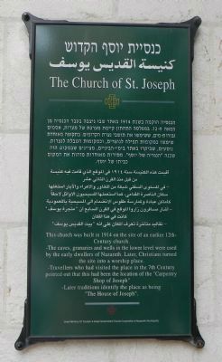
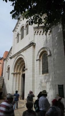
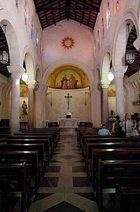
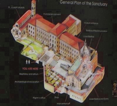
The Church of St. Joseph
[Sanctuario di Nazareth]
[Text in Hebrew …]
[Text in Arabic…]
This church was built in 1914 on the site of an earlier 12th century church.
-The caves, granaries and wells in the lower level were used by the early dwellers of Nazareth. Later, Christians turned the site into a worship place.
-Travellers who had visited the place in the 7th Century pointed out that this had been the location of the “Carpentry Shop of Joseph”
-Later traditions identify the place as being “The House of Joseph”.
Erected by Israel Ministry of Tourism, Israel Government Tourist Corporation, and Nazareth Municipality.
Topics. This historical marker is listed in this topic list: Churches & Religion. A significant historical year for this entry is 1914.
Location. 32° 42.183′ N, 35° 17.9′ E. Marker is in Nazareth, Northern District. Marker can be reached from Paulus Ha Shishi, 0.4 kilometers north of Iksal. Touch for map. Touch for directions.
Other nearby markers. At least 8 other markers are within 14 kilometers of this marker, measured as the crow flies. Architectural Elements of the Church-Synagogue (about 90 meters away, measured in a direct line); The Ancient Village of Nazareth (about 90 meters away); Basilica of the Annunciation (about 90 meters away); Byzantine Mosaics (about 120 meters away); Mount of Precipice (approx. 2.5 kilometers away); The Citadel (approx. 5.9 kilometers away); The Theater (approx. 5.9 kilometers away); Ancient Yodfat (approx. 14.5 kilometers away). Touch for a list and map of all markers in Nazareth.
Also see . . .
1. St. Joseph's Church. Bible Walks website entry (Submitted on July 8, 2011, by Richard E. Miller of Oxon Hill, Maryland.)
2. Nazareth. Wikipedia entry:
... "the Arab capital of Israel," the population is made up predominantly of Palestinian Arab citizens of Israel. (Submitted on July 8, 2011, by Richard E. Miller of Oxon Hill, Maryland.)
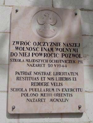
3. Polish II Corps Virtual Muserm. Website homepage (Submitted on October 24, 2023, by Larry Gertner of New York, New York.)
Credits. This page was last revised on October 24, 2023. It was originally submitted on July 8, 2011, by Richard E. Miller of Oxon Hill, Maryland. This page has been viewed 702 times since then and 6 times this year. Photos: 1, 2. submitted on July 8, 2011, by Richard E. Miller of Oxon Hill, Maryland. 3. submitted on July 9, 2011, by Richard E. Miller of Oxon Hill, Maryland. 4, 5, 6. submitted on July 8, 2011, by Richard E. Miller of Oxon Hill, Maryland. • Bernard Fisher was the editor who published this page.
