Near Iatan in Platte County, Missouri — The American Midwest (Upper Plains)
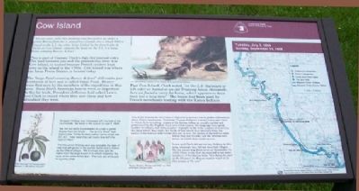
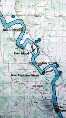
Cow Island
"Set out verry early this morning and proceeded on under a gentle Breeze from the S. passed two Islands one a Small Willow Island on the L.S. the other large Called by the french Isle de Vache or Cow Island, opposit the head of the S.S. is a large Pond containg Beever, & fowl"
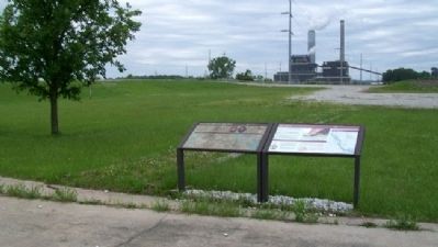
This is part of Captain Clark's July 3rd journal entry. The land between you and the present-day river was Cow Island, so named because French traders kept cows on the island in the 1700s. Cow Island was where the Iatan Power Station is located today.
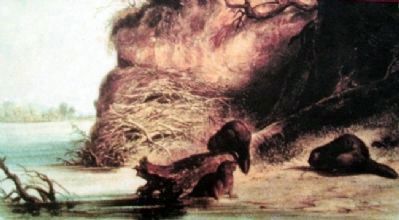
The "large Pond containg Beever, & fowl" still exists just northwest of here and is called Iatan Pond. Beaver were first seen by the members of the expedition in this area. Since North American beaver were so important to the fur trade, President Jefferson had asked Lewis and Clark to record where they saw them and how abundant they were.
Past Cow Island, Clark noted, "on the L.S. (larboard or left side) we halted at an old Tradeing house (deserted), here we found a verry fat horse, which appears to have been lost a long time". The house had been used by French merchants trading with the Kansa Indians.
Sergeant Ordway was impressed with the look of the countryside. He wrote in his journal on July 3, 1804:
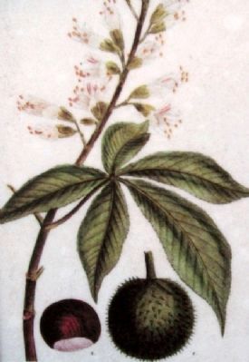
"we Set out eairly & proceeded on under a gentle Breese from the South...The land is Good high bottom pine Timber & black wallnut honey locas oak &C. &C. I saw waat they call bucks Eye with the nuts on them"
The tree which Ordway saw was probably the type of tree that still grows in the central states and is known as the Ohio buckeye. The buckeye tree gets its name from the large brown nuts which resemble the eyes of the white-tailed deer. The nuts are enclosed in a prickly shell.
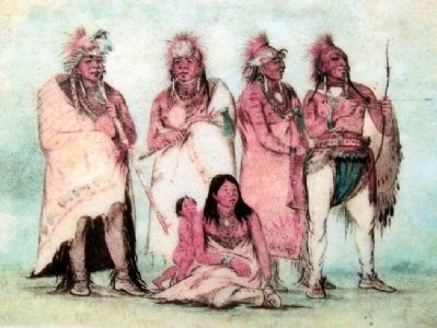
One of the reasons for the Corps of Discovery's journey was to gather information about Native Americans. President Thomas Jefferson wanted Lewis and Clark to obtain facts including: names of the Indian tribes, as usually spelled and pronounced by the English; their own tribal names; the language they speak; number of villages and tents; number of people in the tribe; number of warriors; the place where they trade; the kinds of furs which they annually trap; the names of the nations with whom they are at war; the names of the nations with whom they are friends; and the streams and rivers on which they reside or rove.
Lewis and Clark did not see any Indians in this area, although they did see deserted villages. On the return trip down river on September 24, 1806, Clark wrote that he expected to see some members of the Kansa tribe, "this being the part of the Missouri the Kanzas nation resort to at this season of the year."
Erected by
the St. Joseph Museum, Platte County Vistors Bureau, and The Native Sons of Greater Kansas City.
Topics and series. This historical marker is listed in these topic lists: Environment • Exploration • Native Americans • Patriots & Patriotism. In addition, it is included in the Former U.S. Presidents: #03 Thomas Jefferson, and the Lewis & Clark Expedition series lists. A significant historical date for this entry is July 3, 1803.
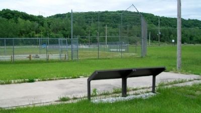
Location. 39° 27.474′ N, 94° 58.176′ W. Marker is near Iatan, Missouri, in Platte County. Marker is on Missouri Route 45/273 near the Iatan Power Plant Access Road, on the left when traveling north. Touch for map. Marker is in this post office area: Weston MO 64098, United States of America. Touch for directions.
Other nearby markers. At least 8 other markers are within 5 miles of this marker, measured as the crow flies. The Lewis and Clark Expedition (here, next to this marker); Wetland Habitats of the Past (approx. 3.9 miles away); Weston Veterans Memorial (approx. 4.7 miles away); Weston Christian Church (approx. 4.7 miles away); Presbyterian Church (approx. 4.7 miles away); Weston (approx. 4.8 miles away); Weston, Missouri, Jail (approx. 4.8 miles away); "Hell's Half Acre" (approx. 4.8 miles away). Touch for a list and map of all markers in Iatan.
Also see . . .
1. Lewis and Clark National Historic Trail. National Park Service
website entry (Submitted on July 12, 2011, by William Fischer, Jr. of Scranton, Pennsylvania.)
2. Discover Lewis and Clark. Website homepage (Submitted on July 12, 2011, by William Fischer, Jr. of Scranton, Pennsylvania.)
3. Journals of the Lewis and Clark Expedition. Website homepage (Submitted on July 12, 2011, by William Fischer, Jr. of Scranton, Pennsylvania.)
Credits. This page was last revised on June 6, 2022. It was originally submitted on July 12, 2011, by William Fischer, Jr. of Scranton, Pennsylvania. This page has been viewed 1,099 times since then and 55 times this year. Photos: 1, 2, 3, 4, 5, 6, 7. submitted on July 12, 2011, by William Fischer, Jr. of Scranton, Pennsylvania.
