Near Middletown in Frederick County, Virginia — The American South (Mid-Atlantic)
Old Hall at Belle Grove
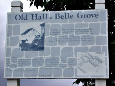
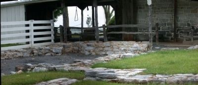
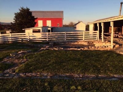
Only the foundation of Old Hall remains today, but it was the seat of Isaac Hite, Jr.'s plantation estate in the early years. Through archaeological excavations and historic photographs, Old Hall has been identified as a substantial limestone structure, two stories high, set on a foundation measuring about 25x40 feet, together with the later addition of extra space and a second chimney. The building had a pitched roof and a sizable cellar. Old Hall is thought to have been used as a residence for the older male Hite children and their tutors in the early 1800's. Excavation of the cellar and surrounding foundation has yielded early 19th century domestic artifacts such as spoons and ceramic sherds, and ample evidence of a Civil War campsite, including canteens, belt buckles and bullets.
This exhibit was made possible through the generous support of the Hite Family Association
Erected by Hite Family Association.
Topics and series. This historical marker is listed in these topic lists: Architecture • Settlements & Settlers • War, US Civil. In addition, it is included in the Former U.S. Presidents: #04 James Madison series list. A significant historical year for this entry is 1783.
Location. This marker has been replaced by another marker nearby. It was located near 39° 1.253′ N, 78° 18.262′ W. Marker was near Middletown, Virginia, in Frederick County. Marker could be reached from Belle Grove Road (Virginia Route 727) half a mile west of Valley Pike (U.S. 11). The marker is on the grounds of Belle Grove Plantation beside the first parking lot just southeast of the barn. Touch for map. Marker was at or near this postal address: 336 State Route 727, Middletown VA 22645, United States of America. Touch for directions.
Other nearby markers. At least 8 other markers are within walking distance of this location. A different marker also named Old Hall at Belle Grove (here, next to this marker); In Honor of Joist Hite (1685-1761) (a few steps from this marker); A Rich Prize (a few steps from this marker); The Shenandoah Valley / Battle of Cedar Creek, October 19, 1864 (within shouting distance of this marker);
Outflanked! (within shouting distance of this marker); Enslaved Quarter Site (within shouting distance of this marker); Cedar Creek Battlefield and Belle Grove (within shouting distance of this marker); Plantation Slavery (within shouting distance of this marker). Touch for a list and map of all markers in Middletown.
More about this marker. On the upper left is a photo of "Old Hall as it appeared in 1885." On the lower right is a diagram of the "Excavations south barn lot" at "Belle Grove 1974".
Related marker. Click here for another marker that is related to this marker. This marker has been replaced by the linked marker.
Also see . . .
1. Belle Grove Plantation. (Submitted on July 14, 2011.)
2. Cedar Creek Battlefield Foundation. (Submitted on July 14, 2011.)
Additional keywords. Cedar Creek, battle, Sheridan
Credits. This page was last revised on October 24, 2020. It was originally submitted on July 13, 2011, by David Graff of Halifax, Nova Scotia. This page has been viewed 1,063 times since then and 44 times this year. Photos: 1, 2. submitted on July 13, 2011, by David Graff of Halifax, Nova Scotia. 3. submitted on November 28, 2015, by Shane Oliver of Richmond, Virginia. 4. submitted on July 13, 2011, by David Graff of Halifax, Nova Scotia. • Bernard Fisher was the editor who published this page.


