Marker Logo HMdb.org THE HISTORICAL
MARKER DATABASE
“Bite-Size Bits of Local, National, and Global History”
Pisgah in Tazewell County, Virginia — The American South (Mid-Atlantic)
 

Pisgah United Methodist Church


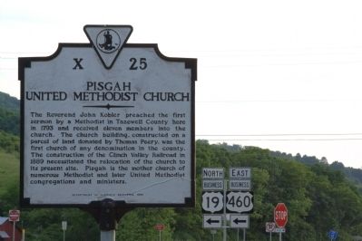
Pisgah United Methodist Church Marker image. Click for full size.
Photographed By J. J. Prats, May 28, 2011
1. Pisgah United Methodist Church Marker
Inscription. The Reverend John Kobler preached the first sermon by a Methodist in Tazewell County here in 1793 and received eleven members into the church. The church building, constructed on a parcel of land donated by Thomas Peery, was the first church of any denomination in the county. The construction of the Clinch Valley Railroad in 1889 necessitated the relocation of the church to its present site. Pisgah is the mother church of numerous Methodist and later United Methodist congregations and ministers.
 
Erected 1989 by Department of Historic Resources. (Marker Number X-25.)
 
Topics and series. This historical marker is listed in this topic list: Churches & Religion. In addition, it is included in the United Methodist Church Historic Sites, and the Virginia Department of Historic Resources (DHR) series lists. A significant historical year for this entry is 1793.
 
Location. 37° 7.258′ N, 81° 34.418′ W. Marker is in Pisgah, Virginia, in Tazewell County. Marker is at the intersection of Trail of the Lonesome Pine (U.S. 460) and Frog Level Road (Business U.S. 19), on the right when traveling west on Trail of the Lonesome Pine. Touch for map. Marker is in this post office area: Tazewell VA 24651, United States of America. Touch for directions.
 
Other nearby markers. At least 8 other markers are within 5 miles of this marker, measured as the crow flies. Fincastle Turnpike
Paid Advertisement
Click on the ad for more information.
Please report objectionable advertising to the Editor.
Click or scan to see
this page online
(about 400 feet away, measured in a direct line); Big Crab Orchard or Witten’s Fort (about 500 feet away); Indian-Settler Conflicts (approx. 1.8 miles away); Roark’s Gap Incident (approx. 2.7 miles away); Tazewell (approx. 2.7 miles away); The James Wynn House (approx. 3.1 miles away); Civilian Conservation Corps Company 1392 (approx. 4.3 miles away); William Wynne’s Fort (approx. 4.4 miles away).
 
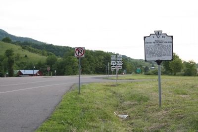
Pisgah United Methodist Church Marker image. Click for full size.
Photographed By J. J. Prats, May 28, 2011
2. Pisgah United Methodist Church Marker
The red building in the distance on the left is the Crab Orchard Museum.
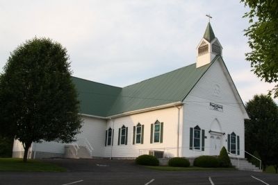
Pisgah Church – 1793 – United Methodist image. Click for full size.
Photographed By J. J. Prats, May 28, 2011
3. Pisgah Church – 1793 – United Methodist
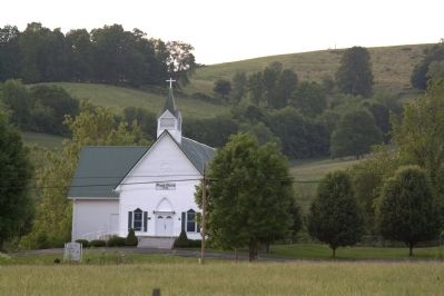
Pisgah Church – 1793 – United Methodist image. Click for full size.
Photographed By J. J. Prats, May 28, 2011
4. Pisgah Church – 1793 – United Methodist
 
 
Credits. This page was last revised on June 16, 2016. It was originally submitted on July 16, 2011, by J. J. Prats of Powell, Ohio. This page has been viewed 775 times since then and 24 times this year. Photos:   1, 2, 3, 4. submitted on July 16, 2011, by J. J. Prats of Powell, Ohio.
Share this page.  
Share on Tumblr
m=44644

CeraNet Cloud Computing sponsors the Historical Marker Database.
This website earns income from purchases you make after using our links to Amazon.com. We appreciate your support.
Paid Advertisement
Apr. 23, 2024